
The Printed Maps of Barbados 1500s – 1980s which cover Ancient Maps, Antique Maps and Historical Maps was in February 2025 split into 5 sections: 1500s – 1700, 1700 – 1800, 1800 – 1900, 1900 – 1980s & Addendums:
- The Printed Maps of Barbados – Part 1: 1500s – 1700
- The Printed Maps of Barbados – Part 2: 1700 – 1800
- The Printed Maps of Barbados – Part 3: 1800 – 1900
- The Printed Maps of Barbados – Part 4: 1900 – 1980s
- The Printed Maps of Barbados – Part 5: Addendums
This work, weaves together the work of three authors and researchers: E. M. Shilstone, Tony Campbell and Alan Moss:

- E. M. Shilstone published “A Descriptive List of Barbados Maps” in 1938 in the fifth issue of the Barbados Museum and Historical Society (BMHS) Journal. (Eustace Maxwell Shilstone was a Barbadian lawyer who in 1933 with his wife, Miss. K. Packer and Mr. L.T. Yearwood founded the Barbados Museum & Historical Society (BMHS). Eustace Shilstone acted as honorary secretary and edited the BMHS journal – the first issue was published in November 1933.)
- Tony Campbell wrote and published “The Printed Maps of Barbados” in 1965, in issue No. 21 of the Map Collectors’ Circle magazine. It is no longer in print, yet remains a valuable resource for historians, genealogists and map lovers.
- Alan Moss published “Further Notes on The Printed Maps of Barbados” in 1993 and 1999 in volumes XLI and XLV of the BMHS journal.
The scarcity of Tony Campbell’s book, yet its significance, became the motivation for this project.
Today, with widespread access to online digital libraries, Jim Webster has added to the original work of Eustace Shilstone, Tony Campbell and Alan Moss expanding this collection of printed Barbados maps.
Sourcing Missing Maps of Barbados, Additional Maps And Map Images
If you can help source images of any of the maps where there is no image or would like to suggest maps of Barbados that should have been included in “The Printed Maps of Barbados 1500s – 1980s” please contact me by either leaving a comment below or clicking on the BajanThings Contact Burts link and choosing from the Subject drop-down: “Barbados Maps – Forward to: Jim Webster”.
Jim Webster – 15th February 2020 (updated February 2025)
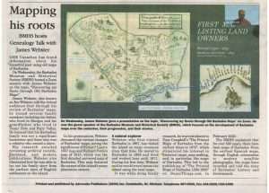
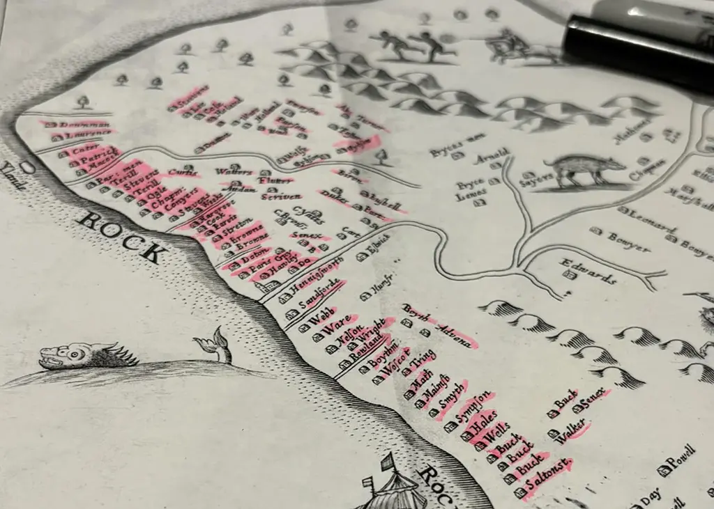
On 24th March 2021 Jim Webster gave a Zoom presentation to the Barbados Genealogy & History Group Meeting which is part of the Barbados Museum & Historical Society. This presentation titled: “Discovering My Roots through Old Barbados Maps” was covered in the Advocate Newspaper on 26th March 2021. Jim’s presentation was recorded and can be viewed via the Barbados Museum & Historical Society Facebook page. (There is no sound for the first 25 seconds.)
If time is limited and you just want to see the maps – you can watch the video compilation below which features many of the Barbados maps covered in this post: