
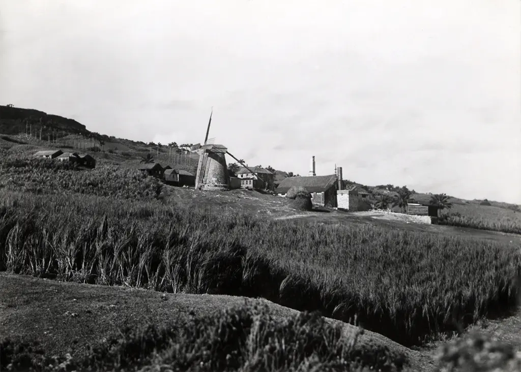
A handbook is sometimes referred to as a: “vade mecum” (Latin for “go with me”) or pocket reference or quick reference guide.
Wikipedia
The Handbooks of Barbados, during the period of 1912 – 14, presented a comprehensive guide to most everything about Barbados: part visitor guide, weather guide, political guide, island directory, history book, guide to tariffs, fees and railway fares and a listing of sugar-works (estates). These Handbooks covered it all.
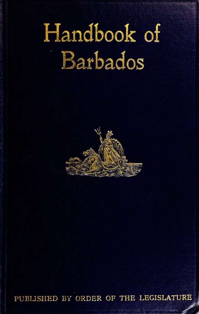
In 1911, Police Magistrate E. Goulbourn Sinckler took it upon himself, at the inducement of his friend N. Darnell Davis, to compile a Barbados Handbook of ready facts and information.
When encouraging his friend to tackle the Handbook project, Darnell Davis must have been well aware of the hours of research, compilation and editing required with such a project, having himself done extensive research on Barbadian history for his 1887 publication, “The Cavaliers and Roundheads of Barbados.”
By the time the 1912 Handbook was ready for publication, Sinckler had come to the realisation of projects scope when he wrote in the introduction: “To the man or woman who undertakes to criticise the work, I shall only put one question, have you ever compiled a Handbook? If you have not, keep silence, – yea, even from good words.”
The Handbooks of 1912 – 14 were by no means the first books of this type to be published in Barbados. The Barbados Almanacs, with similar information, had been in publication by various individuals / companies over a period of 100 years from the 1700s until as late as 1871. The Handbooks of Barbados were only published for a span of three years after which, whether due to the start of the war in Europe or other circumstances, they were discontinued.
It’s not my intent to give a full overview of the content of the Barbados Handbooks or Almanacs but rather to focus on the Barbados Sugar-Works and Plantations listed within the books.
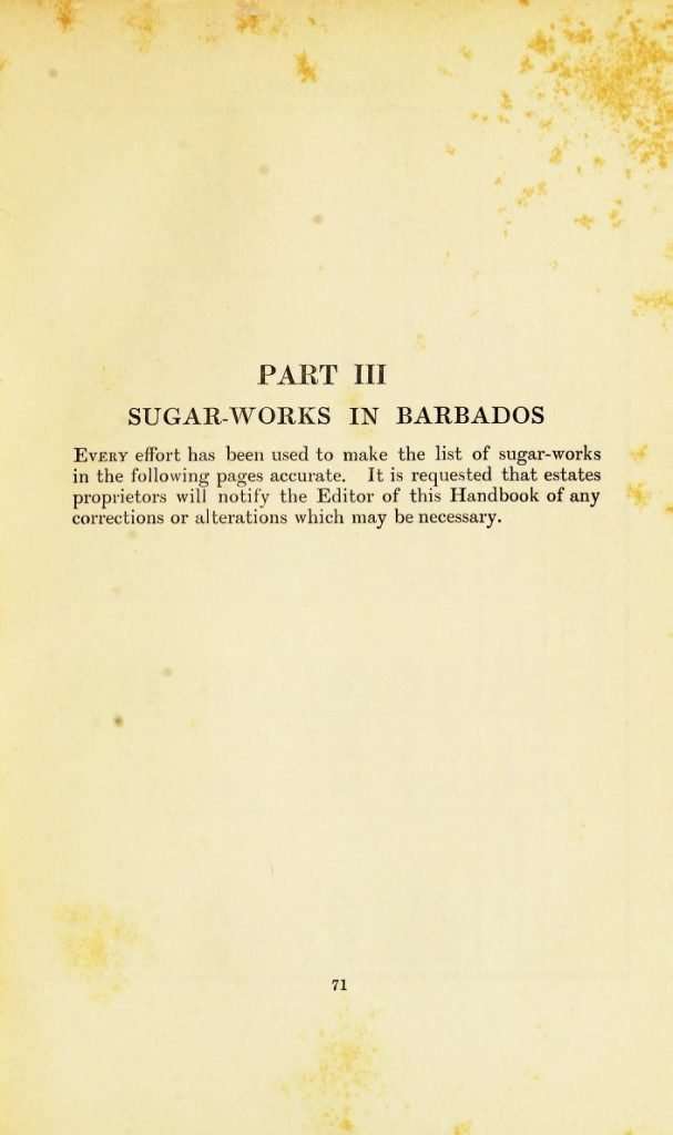
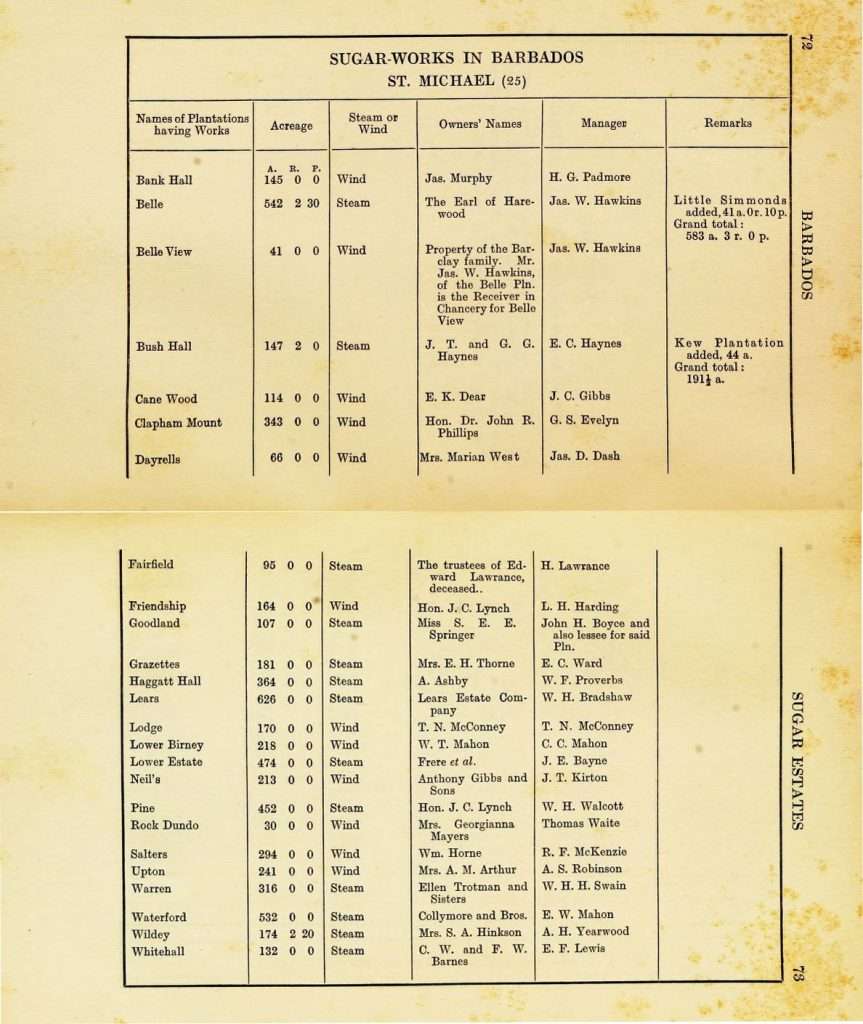
from the Handbook of Barbados -1912
The years from 1912 to 1914 marked a transition period in the history of Barbados sugar industry. Published just before the start of the First World War, the Handbooks give a detailed snapshot of Barbados at that time. In the preceding years many Barbadians had emigrated to the United States, Canada and the Panama Canal region. In particular, funds from Panama workers were sent back to help their families in Barbados.
In 1911 the Barbados House of Assembly passed an act supporting the establishment of large, central sugar-grinding factories. What had once been a sugar industry with over 400 small factories was now down to 112 steam and 219 wind driven sugar-works in 1913. By 1968 this number had fallen to 14 factories and by 2014, with the closure of Andrew’s Factory in 2013, Portvale became the only operational sugar factory.
The sugar-works were used to grind the sugar cane squeezing out the juice so that it could be boiled and processed into sugar and molasses. The Barbados Handbook of 1912 only included plantations with operating steam and wind power sugar-works. The 1913 and 1914 handbooks also included those plantations where the sugar-works had been removed or had ceased operation because the land was consolidated into larger estates, broken up into tenantries or sold as lots.
In addition to the sugar-works data from the Barbados Handbooks 1912 – 14, data for 1924, published in BMHS (Barbados Museum & Historical Society) Journal Vol. XLV has also been incorporated into the table below. This list originated from the papers of the late Robert Taylor and help highlight changes within the sugar industry since 1914, such as, plantation ownership, amalgamations, consolidation of operations and the further conversion of land from agriculture to lots and tenantries.
Transitional Times in the Sugar Industry
There has been much written about the struggles within the British West Indian sugar industry post-emancipation both for the plantation owner and the workers that relied upon sugar for their livelihood. Unlike a number of colonies where estate ownership was largely non-resident, Barbados maintained a higher level of local ownership than most with less than 50% of the cultivated land, according to the 1861 Barbados Almanac, foreign owned.
Up until the 1850s the British West Indies had a virtual monopoly in the importation of sugar into Great Britain. That began to change with the introduction of sugar beets as a crop and alternate source for sugar. Soon the Europeans were providing a subsidy or bounty to their local sugar beet producers driving down the price and the cost to residents of Britain and other markets. Over the course of ten years sugar imports from the West Indies dropped dramatically as it was replaced by the cheaper European sugar. Even though islands such as Barbados were British colonies Britain wouldn’t impose counter tariffs to balance out the price and make cane sugar competitive.
The Barbados Planters worked hard to maintain control of their sugar production and land ownership refusing to adopt the Encumbered Estates Act of 1854 which, in the case of bankruptcy, assigned ownership to those that held liens against an estate, most often British Commercial firms. In 1882 Barbados passed legislation against the assignee lien.
Instead the indebted Barbadian plantocracy chose an alternate path utilising the Chancery Court to help restrict the sale of estates to outside interests. As we shall see, this was to be very fortuitous for a number of Barbadian families who, at the end of the 19th century, were both astute enough and financially able to purchase estates out of Chancery, often for pennies on the dollar of previously appraised value.
Top Landowners by Acreage and Plantations (PLTN) Owned in 1924 – 1935
(On a mobile or tablet swipe to see all years)
| Plantation Owner | 1912 Acreage | 1912 Plantations | 1913 Acreage | 1913 Plantations | 1914 Acreage | 1914 Plantations | 1924 Acreage | 1924 Plantations | 1935 Acreage | 1935 Plantations |
|---|---|---|---|---|---|---|---|---|---|---|
| Pile | 3,446 | 13 | 3,273 | 11 | 3,370 | 12 | 4,196 | 14 | 3,575 | 12 |
| Gill | 749 | 6 | 749 | 6 | 749 | 6 | 3,863 | 16 | 1,943 | 10 |
| Ward | 1,783 | 9 | 2,164 | 10 | 2,164 | 10 | 3,773 | 13 | 3,501 | 16 |
| Haynes | 2,878 | 15 | 2,878 | 15 | 2,848 | 14 | 3,253 | 13 | 2,717 | 10 |
| Springhall Co. Ltd. | 0 | 0 | 0 | 0 | 0 | 0 | 2,293 | 7 | N/L | N/L |
| Applewaites Ltd. | 0 | 0 | 0 | 0 | 0 | 0 | 2,247 | 5 | N/L | N/L |
| Thorne | 867 | 3 | 867 | 3 | 867 | 3 | 1,907 | 7 | 1,340 | 4 |
| Foursquare Company Ltd. | 0 | 0 | 0 | 0 | 1,067 | 1 | 1,776 | 1 | N/L | N/L |
| Yearwood | 2,421 | 8 | 2,150 | 7 | 1,886 | 6 | 1,684 | 5 | 1,469 | 4 |
| Wilkinson | 0 | 0 | 0 | 0 | 0 | 0 | 1,681 | 2 | 1,501 | 2 |
| Williams | 1,285 | 4 | 1,380 | 6 | 1,290 | 5 | 1,651 | 5 | 1,561 | 4 |
| Cameron | 1,112 | 1 | 1,112 | 1 | 0 | 0 | 1,623 | 2 | 0 | 0 |
| Clarke | 1,728 | 8 | 1,728 | 8 | 2,549 | 10 | 1,607 | 8 | 1,762 | 7 |
| Skeete | 1,533 | 6 | 1,778 | 7 | 1,778 | 7 | 1,573 | 4 | 1,817 | 5 |
| Farmer | 593 | 2 | 802 | 3 | 802 | 3 | 1,483 | 5 | 0 | 0 |
| Pilgrim | 2,109 | 4 | 2,109 | 4 | 2,189 | 5 | 1,478 | 4 | 0 | 0 |
| Challenor | 0 | 0 | 0 | 0 | 0 | 0 | 1,316 | 4 | 1,110 | 4 |
| Evelyn | 716 | 3 | 716 | 3 | 1,113 | 5 | 1,282 | 2 | 0 | 0 |
| Watson | 1,310 | 4 | 1,310 | 4 | 1,310 | 4 | 1,198 | 4 | 0 | 0 |
| Chandler | 1,038 | 4 | 1,038 | 4 | 908 | 4 | 1,197 | 5 | 1,064 | 4 |
| Plantation Owner | 1912 Acreage | 1912 Plantations | 1913 Acreage | 1913 Plantations | 1914 Acreage | 1914 Plantations | 1924 Acreage | 1924 Plantations | 1924 Acreage | 1935 Plantations |
1935 Data taken from Barbados Year Book and Who’s Who 1935: Advocate Press, Barbados 1935
When you look at the tables above you’ll see that in 1924 the largest owners by surnames are Pile, Gill, Ward and Haynes. Two of the four families had been plantation owners for generations while the Ward Family, acquired their first plantation from Chancery in 1900.
The Haynes family can be found on plantation ownership records going back to 1674 at New Castle, St. John and over the centuries have owned a variety of estates throughout the island including Clifton Hall, Bath, Haynes Hill, Bissex Hill and others.
The Pile family are recorded on Barralier’s, 1825 map of Barbados with Conrade Pile listed as owner of Brighton and Sedgwicks, St. George. The family still owns Brighton’s to this day. When I was inquiring about the Pile family, Barbados historian Karl Watson recalled a Bajan saying from his youth, “The Howells only spoke to the Sealy’s, the Sealy’s only spoke to the Pile’s and the Piles only spoke to God!”
Rev. C. C. Gill, the Rector of Christ Church Parish Church from approximately 1833 is recorded as owner of Adam’s Castle from 1854. Over the intervening years the Gills would add a number of additional plantations until the sixteen recorded in 1935, in the Barbados Yearbook and Who’s Who.
The Ward brothers came from Penny Hole, St. Philip, where their father, a shoemaker by trade, had saved enough to buy a plot of between 10 – 20 acres. It was enough land to get on the list of eligible voters in 1871. Although the family had settled in Barbados, with the arrival of James and Robert Ward, in 1635 it wasn’t until the 20th century that their descendants became landowners of any extent. Through hard work, saving and business acumen the brothers Lisle, James, William and Aubrey had acquired enough financial resources to purchase Cane Vale from Chancery in 1900. In the coming years they went on to purchase a total of twelve estates from Chancery, sometimes individually and on other occasions with one of their brothers or another family member. Once established, they acquired a number more estates, both in Barbados and Antigua through private purchases.
The family influence would continue to grow through much of the 20th century as they diversified beyond the sugar industry. The Ward name is often associated with Mount Gay Rum, named after Mount Gay plantation which was owned by Aubrey Ward.
It is clear, from the Barbados Handbooks that while many of the traditional plantocracy still maintained a dominant role in the sugar industry that there were new families growing in influence.
Influence Beyond the Sugar Industry
A keyword search of the 1912 Barbados Handbook gives a clear indication of the influence of both the Pile and Haynes families, during that period. In particular, the largest individual landowner in Barbados, in 1912, the Hon. George Laurie Pile figures prominently in the Handbook owning over 2300 acres while renting others. Mr. Pile was a Member of the Legislative Council, Vice President of the General Agricultural Society, a Magistrate, as well, as the Chairman of the Board of Directors of the Barbados Foundary Ltd. In his free time he was able to establish Bulkeley Central Factory, one of the new modern factories built as the sugar industry moved to a centralized factory model and sit on the Board of the Barbados Railway.
A. J. Pile, a cousin of George Laurie was the owner of Green’s, St. George, a representative from St. Peter to the Legislative Council, an attorney for 30 estates and Speaker of the House. Rounding out the Pile family was R. P. Pile, a solicitor with Cottle, Catford and Co.
A search on the Haynes Family in the Handbook is equality impressive and perhaps indicative of an even broader reach than the Pile family influence. R. Haynes is a member of the Legislative Council, the Solicitor General, a Magistrate and also on the Board of the Barbados Foundry. A. P. Haynes is the representative for St. Andrew, C. A. Haynes is on the Volunteer Police Force, W. L. Haynes is the Deputy Registrar, R. W. W. Haynes is a dentist and E. C. Haynes the manager of the Bridgetown Garage.
“One of the key supporting industries to the sugar-works were the foundries that produced the heavy rollers used to crush the cane. In early days these rollers came from Great Britain.
In later years there were two foundries in Barbados, namely Central Foundry and the Barbados Foundry on White Park Road (now the court buildings).
The Barbados Foundry had the ability to make and replace many parts of the mill itself, including making new rollers, and the brass bearings in which they rotated. They had several massive lathes needed to cut the various grooves found on the surface of a cane roller.
Keep in mind that these steel monsters weigh several tons apiece, and a mill station consists of three. A modern factory had at least 3 “stations”, i.e. the cane was crushed three times, and sometimes more. Several techniques are used to maximise juice extraction, and hence recovery of the inherent sucrose.
Much effort was made to grow sugar cane varieties that provide better sugar content and resistance to insect damage.”
James S. Webster
The Gill and Ward family names didn’t produce any results when searching the 1912 Barbados Handbook other than in the listing of sugar-works owners and managers.
Historically it had been the plantocracy who were the decision makers in Barbados society and it was clear that as the island moved into the 20th Century many of those traditional planter families wished to maintain their influence by migrating into other areas of business. This is a trend that would continue as the sugar industry continued to wind down in the coming years.
Plantation Homes as they stand in the early 21st century


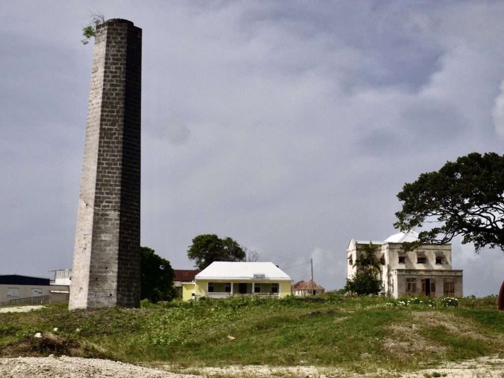
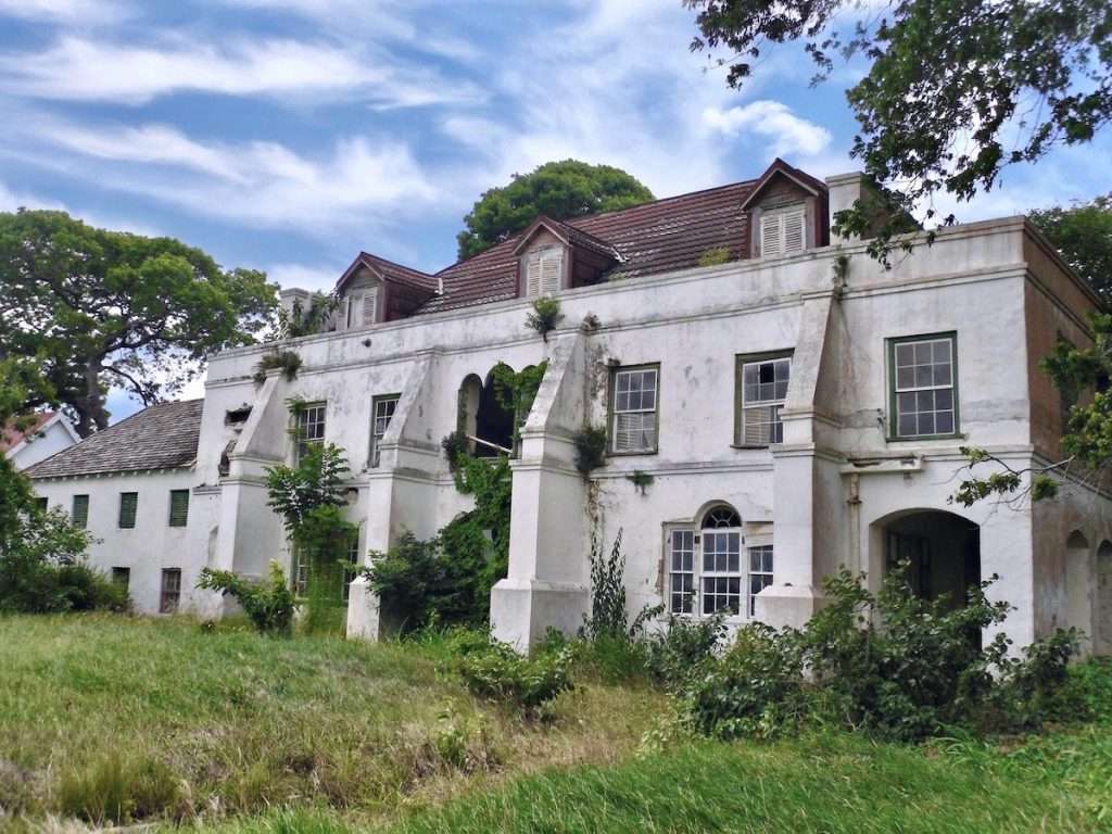
Plantation houses photo credit: Mohammed Patel
Let the Tables Talk
By playing with the sugar-works tables and doing a little detective work we can extract a lot of interesting information. This example not only shows the number and types of sugar-works but also their decline in number even in the period of 1912 to 1914. Between 1914 and 1924 many more estates were consolidated or broken into lots which would have reduced the sugar-works further.
| Sugar-Works | 1912 | 1913 | 1914 |
|---|---|---|---|
| Steam | 113 | 111 | 111 |
| Windmill | 219 | 216 | 204 |
| Two Windmills | 2 | 2 | 2 |
| Wind & Steam | 1 | 1 | 1 |
| Total | 335 | 330 | 318 |
Sugar-Works Early 20th Century

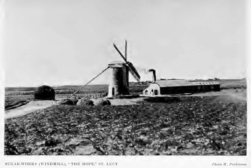
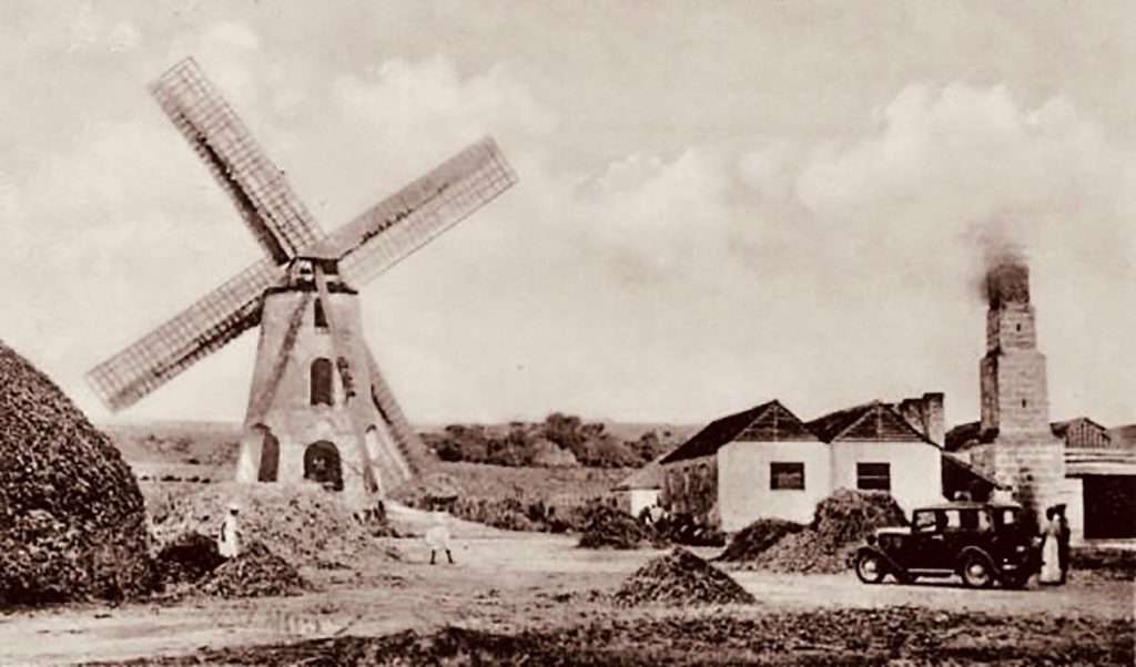
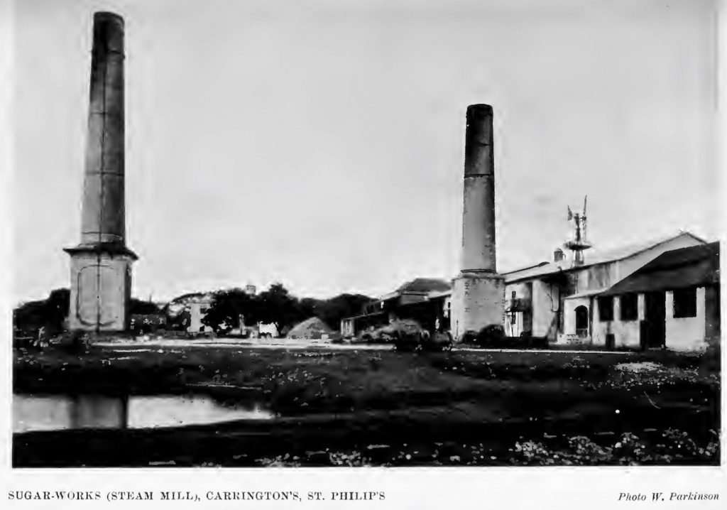

Getting the Most from the Handbook Sugar-Works Tables
We have provided the table below in a format that allows for the quick retrieval of information whether it be by plantation name, size, wind or steam operation, ownership or manager, All the data has been transcribed from the original publications so we would recommend if you are doing serious research that you refer to the source. An additional, and invaluable source are the Hughes – Querree Papers available through the Shilstone Library at the Barbados Museum and the Barbados Archive, Black Rock.
The information contained in these tables is provided on an “as is” basis by the authors. Plantations and Sugar works in Barbados 1912-14 & 1924 were transcribed by Frances Ward and Jim Webster from multiple sources that include:
- the 1912, 1913, 1914 Barbados Handbooks and
- the Barbados Museum and Historical Society Journal Vol. XLV
Using the Sugar works in Barbados 1912-14 and 1924 Table
The Plantations and Sugar works in Barbados 1912-14 and 1924 is scrollable horizontally and vertically. On a laptop you use the up, down, left and right arrows to move within the table. On a phone or tablet, swipe left or right, up or down within the table.
You can also sort by a column by clicking the arrow adjacent to the column title in the table header.
Multi-column sorting is also possible – but only on a laptop or a device with a keyboard. Sort the first columns. For subsequent columns you need to press the SHIFT key, then click on the up or down arrow adjacent to the column name in the table header. You can tell the columns that have been sorted as they only show a red arrow. Unsorted columns show an up and down arrow.
By sorting on the “Owner” or “Owner Surname” column we can learn which individuals or families, or companies were the biggest land owners by number of estates, or number of acres; whether the same owners were in a similar position in 1924 as they were in 1912. Who owned the largest estate and who owned the smallest, which had been consolidated and which had been sold off in lots?
You can also filter fields using the search box. For example put in: “Lion Castle” and you will see all rows that contain the text “Lion Castle” or put in a name such as: “Parris”. This is a simple text based search. It does not handle complex searches like “Parris” OR “Mahon” or “Parris” AND “Mahon”.
In addition at the top left of the table you can paginate the table and choose to show, 10, 25,50,100. If you choose say 10 lines per table you can page through the other sheets by pressing the Previous or Next links or the left or right navigation arrows at the bottom right of the table.
- _Unlisted – the information was not in the original documents
- _Consolidation is used when plantations have been combined into one operation
- _No Works means the wind or steam works are no longer in operation or exist
- _Sold in Lots – plantations which were subdivided on sold as small lots usually an acre or two
Please note there are 1,465 rows of data in the table!
| Plantation Name | Year | Parish | Acreage | Sugar-Works | Wind | Steam | Sugar-Works Details | Owner’s Name | Owner’s Surname | Manager’s Name | Source | Record ID |
|---|---|---|---|---|---|---|---|---|---|---|---|---|
| Adams Castle | 1912 | Christ Church | 287 | Steam | 1 | Ward, E. L. (Edmund Lisle) | Ward | Webster, Joseph Evan | B’dos Handbook 1912 | 1912-000001 | ||
| Airy Cot | 1912 | St. Thomas | 33 | Wind | 1 | Nurse, A. H. (Allan) | Nurse | Nurse, A. H. (Allan) | B’dos Handbook 1912 | 1912-000002 | ||
| Alleynedale | 1912 | St. Peter | 350 | Wind | 1 | Chandler, Mrs. E. D. | Chandler | Seale, Allan (Prescod) | B’dos Handbook 1912 | 1912-000003 | ||
| Amity Lodge | 1912 | Christ Church | 42 | Wind | 1 | Bonyun, W. A. (Walter Audley) dec’d, The executors of | Bonyun | Bynoe, W. A. | B’dos Handbook 1912 | 1912-000004 | ||
| Andrews | 1912 | St. Joseph | 310 | Steam | 1 | Gibbs, Anthony and Sons | Gibbs | King, W. M. | B’dos Handbook 1912 | 1912-000005 | ||
| Apes Hill | 1912 | St. James | 433 | Wind | 1 | Austin, Charles. B. | Austin | Austin, Charles. B. | B’dos Handbook 1912 | 1912-000006 | ||
| Appleby | 1912 | St. James | 37 | No Works | Greaves, K. J. (Kenneth James) | Greaves | B’dos Handbook 1913 – details applied to 1912 | 1912-000007 | ||||
| Applewhaite’s | 1912 | St. Thomas | 456 | Steam | 1 | Cobham, J. | Cobham | Edghill, G. C. | B’dos Handbook 1912 | 1912-000008 | ||
| Arthur Seat | 1912 | St. Thomas | 115 | Wind | 1 | Kirton, S. B. | Kirton | Webster, J. (lessee) | B’dos Handbook 1912 | 1912-000009 | ||
| Ashbury | 1912 | St. George | 315 | Steam | 1 | Nourse, Colonel A. H. | Nourse | O’Neal, A. L. | B’dos Handbook 1912 | 1912-000010 | ||
| Plantation Name | Year | Parish | Acreage | Sugar-Works | Wind | Steam | Sugar-Works Details | Owner’s Name | Owner’s Surname | Manager’s Name | Source | Record ID |
Download the Consolidated 1848 to 1924 Sugar-Works Data
Should you want to do complex filtering or pivots, beyond what is offered in the tables above, you can click here to download the complete Plantations and Sugar works in Barbados 1848-1924 spreadsheet. The data is in Google Sheets format and may be downloaded from there in .pdf, .xlsx or .csv formats. This spreadsheet consolidates the Barbados Almanacs 1848 to 1871 data, the Barbados Handbook 1912 -1914 and data for 1924 from BMHS (Barbados Museum & Historical Society) Journal Vol. XLV.
Alternatively the you can click here to download the subset of Plantations and Sugar works in Barbados 1914-1924 spreadsheet.
Please note the disclaimer attached to the spreadsheet. The data contained in the spreadsheet was transcribed from antique sources, most over one hundred years old. The authors assume no responsibility or liability for any errors or omissions in the content. The authors make no warranties about the completeness, reliability or accuracy of the information. The information contained in these tables is provided on an “as is” basis by the authors. Any action you take using this data is strictly at your own risk.
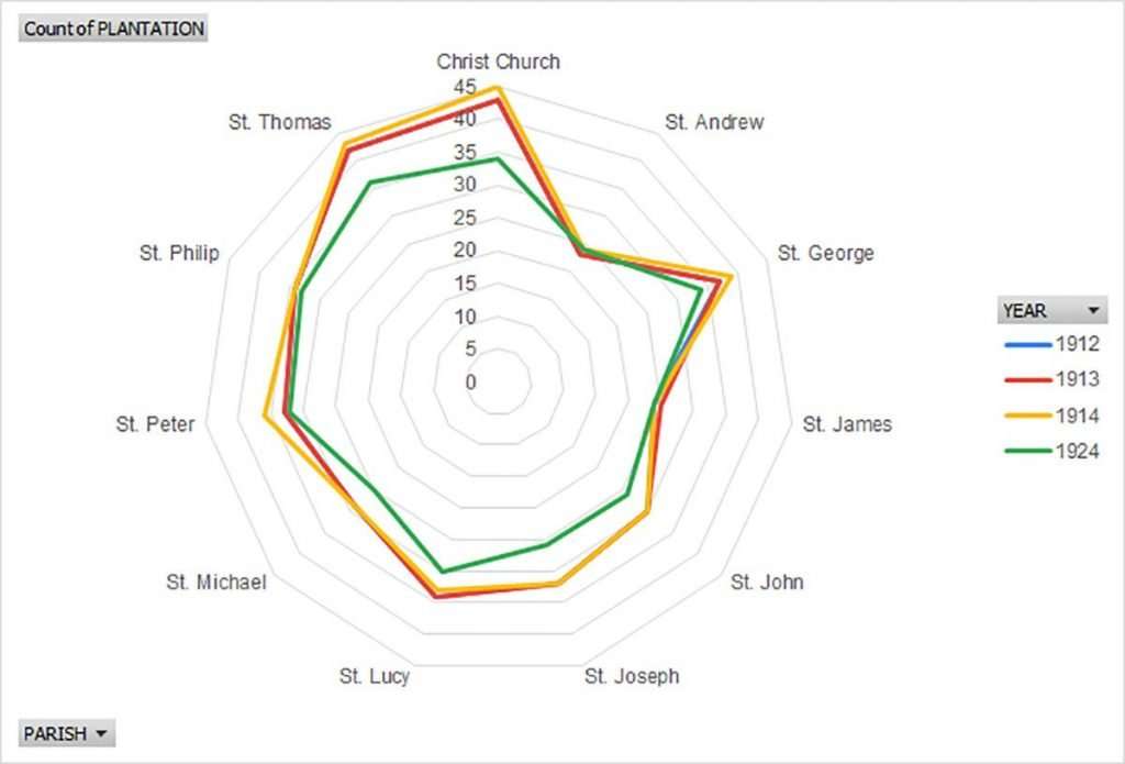
Here is an example of what is possible and shows how the number of plantations in Barbados shrunk by Parish from 1912 to 1924. This trend would continue beyond 1924 as more plantations consolidated or land was converted to housing or industrial uses. (1912 was almost identical to 1913 thus the reason the blue line doesn’t appear.)
Errors
If you spot an error please contact me by either leaving a comment below or clicking on the BajanThings Contact Burts link and choosing from the Subject drop-down: “Barbados Maps/Plantations – Forward to: Jim Webster“. Please detail the error together with the “Record ID” so it can be found.
Many thanks
Jim Webster
20th May 2020.
References
- Barrow, Christine – Ownership and Control of Resources in Barbados: 1834 to Present by Author (1983)
- Goddard, Robert – “The Fall of the Barbados Planter Class: An Interpretation of the 1980s Crisis in the Barbados Sugar Industry.” Agricultural History, vol. 75, no. 3, 2001, pp. 329–345.
- Sinckler, E. Goulburn – The Barbados Handbook 1912
– Contents
– Part III – Sugar-Works in Barbados
– Part IX – Minerals Resources of Barbados – R H Emptage - Richardson, Bonham – The Impact of Panama money in Barbados in the early twentieth century
- Marshal, Woodville and Watson, Karl – Of Halls, Hills and Holes: Place Names of Barbados
- Old Barbados Photos – Facebook
- Caribbean Photo Archive
- familysearch.org