
The Cordillera Huayhuash (pronounced Y-WASH) is a mountain range in Central Peru. It is a sparsely populated region but well known for it’s many 6,000+ Meter mountains, glaciers and rugged terrain. It’s a magnet for mountaineers and hikers from all over the world.

In August 2010 I joined a group for a 14-day hike in the area. I flew to Lima via Miami where I spent one night. Next morning after meeting the group we took an 8-hour bus ride to Huaraz, the commercial, hiking and administrative centre of the Ancash Region.
A major earthquake on May 31st 1970 killed 70,000 people and demolished most of the city but buildings built 2000 years ago survived the numerous earthquakes that have occurred since then. This is an often-overlooked tribute to the Inca engineers of long ago.
Huaraz is 3,000 meters above sea level and we felt minor effects of the elevation. This is caused by reduced concentration of oxygen molecules in every breath. The first effects are shortness of breath, and tiredness. It can get worse and in extreme cases will lead to death. Below 4,000 meters most people usually acclimatize in a day or two.
We spent 3 days getting accustomed to the elevation and doing some test hikes to about 3,500 meters.
Llamac is the start point of the hike and is an 8-hour bus trip over twisting and pot-holed mountain roads. Some bends are so sharp the driver did a 3- point turn. On board were 7 hikers, 5 support staff and all the food, tents, medical and general supplies for 14 people for a 14-day hike. I have great respect for the driver.
That evening was spent sorting the gear and supplies required for the expedition. We also walked into town to taste the local beer, which was chilled in the river.
Next morning we were joined by 14 donkeys and two “donkey men” to carry our supplies. This is welcome source of income for the local population. Every group hires donkeys and their owners as guides. The route is not marked and although you could walk with a map, compass and careful navigation this isn’t advisable.
The trek is entirely over 4,000 meters with most days crossing mountain passes of over 4800 meters and one of over 5,000 meters. The effects of altitude are noticeable on anyone used to sea level. With the reduced accumulation of oxygen in the blood the heart rate increases. This can lead to other problems.
We encountered bright sun, rain, snow, hail and sleet, sometimes all in the space of a few hours. In my backpack was waterproof and warm gear in addition to a camera, water, snacks, first aid kit, sun block and a packed lunch.
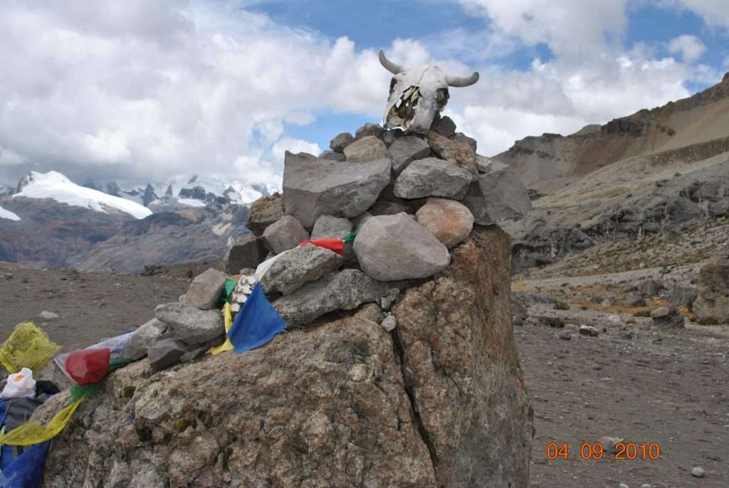
The circuit winds around the Huayhuash range following valleys and mountain passes. The Inca used these routes for many generations, long before Europeans arrived.
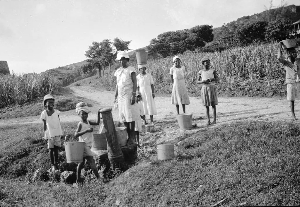
Occasionally we would pass a few thatched roofed houses with wood and mud walls. They are self sufficient in potato, corn, vegetables, chickens, pigs, sheep and cattle. The sweet potato originally came from Peru many centuries ago.
Unfortunately they have no access to health care, school or other things we take for granted. It is not uncommon to talk someone who has never been to school but can speak Quechua (their local language), Spanish and English. I have had the best education that Barbados can offer but I can only speak English!
The route offers fantastic views of the mountains, with many glaciers and ice fields descending into raging rivers making their way to the Atlantic Ocean via the Amazon. A camera with a large memory card is essential!
We passed Siula Grande (6,344Meters) that Simon Yates and Joe Simpson climbed in 1985. On the way down Joe fell into a crevasse and was presumed dead. He crawled out with broken limbs to reach their camp three days later. This is one of the most amazing mountaineering survivor stories. Seeing the route (from a long way away) he took made me realize how determined he was to live.
Most nights we camped by a lake or river where we could get water and sometimes fresh fish. However there was no swimming as the water was fresh off the ice cap! Anything that got wet stayed wet. It rained every day and at night the temperature went below freezing. Then the rain turned to snow or ice. At night a trip to the toilet was done as quickly as possible.
Food is an important aspect of any trip like this. Each day you burn 3,000 to 5,000 calories. If you don’t eat good and nutritious food you will soon feel the effects. It is a good, but drastic, way to loose weight!
Breakfast was about 6.30 am with a hot cup of tea, coffee or Chocolate drink, and then eggs, oats, tea, peanut butter, bread, and fruit.
Packed lunch was bread, cheese, fruit, juice and whatever we brought as our individual supplies. When we reached camp, around 4pm, we had a hot drink and biscuits with jam, peanut butter, etc.
Dinner was Chicken stew (We carried live chickens), with potatoes, vegetables, soup and bread. If the fisherman was lucky we got fresh fish. After the last of the chickens and fresh vegetables was used pasta and cheese was a staple food. I am amazed by the way the two cooks provided the meals for us. No one could complain about the food.
I was in my tent by 8pm to arrange my pack and then get into my sleeping bag. Sleep came easily.
This trek is a physical and mentally demanding one. Any one who likes wild camping and has the necessary experience and gear would enjoy it. The memories will last me for the rest of my life.
You can click on the thumbnail image to see a larger image with captions.