I am not a geologist nor do I have training in any related field. This article is based on my own observations and reading.
The land between Ragged Point and the Airport from the coast stretching inland between 500 meters and 1Km is flat coral rock with very little soil covering it. Before humans arrived it would have been a barren, featureless, flat, dry and rocky land covered by a few trees and scrubs. It has been referred to as the East Point Shelf.
On the seaside are cliffs between 10 and 20 meters high. A few small bays with beaches dot the coast line.
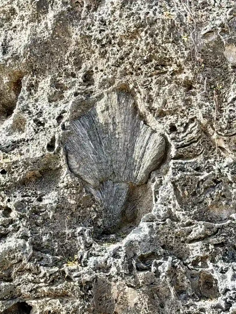
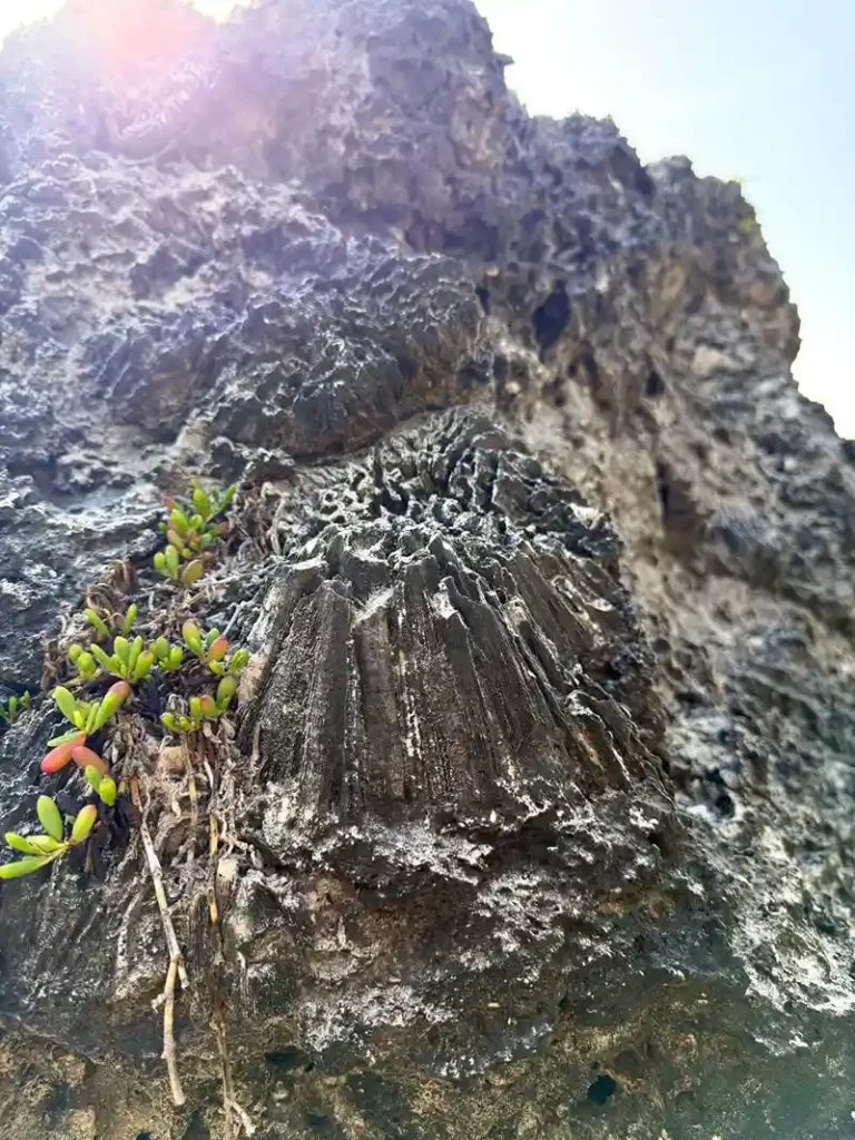
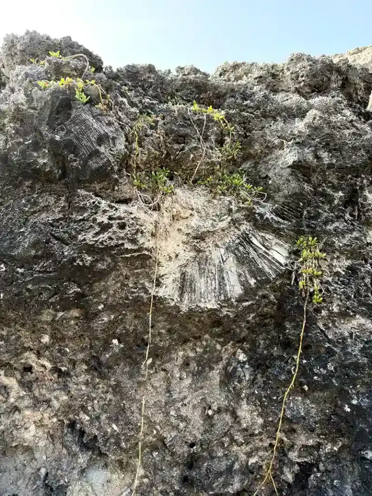
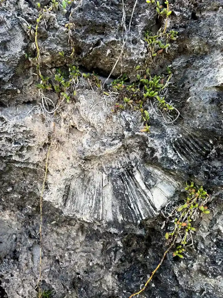
This land was below the sea level 500,000 to 1 million years ago. It gradually rose, or the sea level dropped, to its present level. The area is littered with coral fossils on the cliff face. Some are a few centimetres and some are several meters in size.
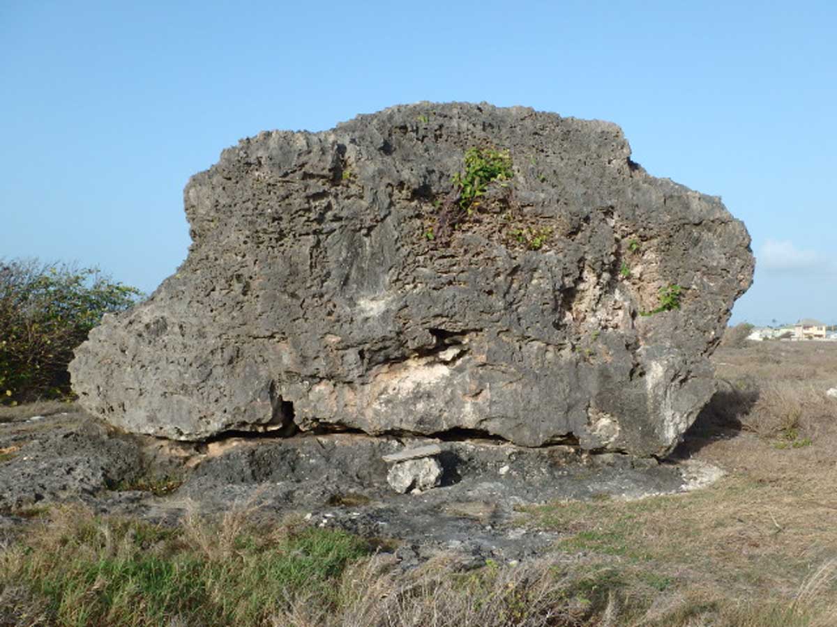
One noticeable feature is a large bottom-up boulder lying on top of the terrace near the cliff face between Bottom Bay Beach and Harry Smith Beach. It is approximately 4 Meters high and 10 meters in diameter and 10 meters from the cliff. It rests on the flat coral base and doesn’t appear to be attached to the bedrock.
There are no other natural features higher than this for several Kilometres. It could not have rolled down from any cliff as with the case with similar boulders in St. John and St. Joseph.
I find it interesting that the coral fossils embedded in this boulder are all inverted. This means that the rock rolled over 180 Degrees after the fossils were made.
Local folklore says it was a giant tsunami that took it from the sea and put it on top of the cliff. That would have been a very big one.
My opinion is that it was inverted by the sea when this area was underwater. Possibly by a Tsunami. I think that after it was inverted it remained there for a long time with parts of it out of the sea.
It may have been a sea stack that broke off at the base and rolled over.

There are several smaller rocks in the area that do not appear to have been turned over. However one is close by that has been rotated by 90Deg. This is a relatively small one and it is possible that it was moved by several people a long time ago.
Whatever the reason I hope that this piece of our natural history will be preserved and not broken up by the development that is taking place in the area. In forward- thinking countries this would be classified as an “Area of Scientific Interest” and protected for future generations. This is unlikely to happen in Barbados.
For a guide to the Geology of the island read “Geology of Barbados” by Hans G. Machel.
For those wishing a coastal walk there are two options. Continue South-West from the Rock and pass Harry Smith, Little Harry Smith (with the old salt water swimming pool) and Sam Lords Castle. All are ruins. If you look carefully, around Little Harry Smith, you can still see the depressions that were once ponds for attracting migratory birds.
There are steps cut in the cliff face to these beaches.
If you go East, take the track between the last two houses on the left as you drive down to Bottom Bay. You will come to the seldom visited Peat Bay. There are steep steps down. Soon after you will pass an abandoned development. Built by Harlequin and paid for by people with lots of dollars to waste.
Next is Coles Pasture with a small bay where extreme body-boarders go to surf. Do not attempt this unless you are very experienced and go with someone who has done it before.
Continue along the coast to Ragged Point without passing any houses. Be sure to carry water as it is very dry and there are no shops along the coast. You can return along the coast or go inland until you meet a road. This way you will pass a few shops where you can get a drink, but it is a longer walk.
Below are a selection of photos of the inverted boulder and fossils between Bottom Bay and Harry Smith Beach. You can click on the thumbnail images below to see a larger image with captions.


Son additional images:
Further reading on the geology of Barbados
- GEOLOGY OF BARBADOS. A brief account of the island’s origin and its major geological features. Hans G. Machel
- The geology of Barbados: a field guide. STEPHEN K.DONOVAN (including a joint contribution with DAVID A.T. HARPER)
- The Geology of Barbados. John Burchmore Harrison, Alfred John Jukes-Browne