
·
The 1679 Barbados Census – a searchable database
The 1679 Barbados census offers one of the earliest and most complete snapshots of colonial society in the English-speaking world. It captures land ownership, plantation structure, and demographic patterns at a time when Barbados was the wealthiest colony in the British Empire. For genealogists and historians, it provides essential insights into early family names, migration,…
·
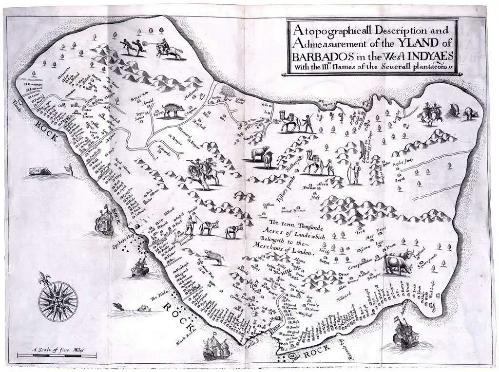
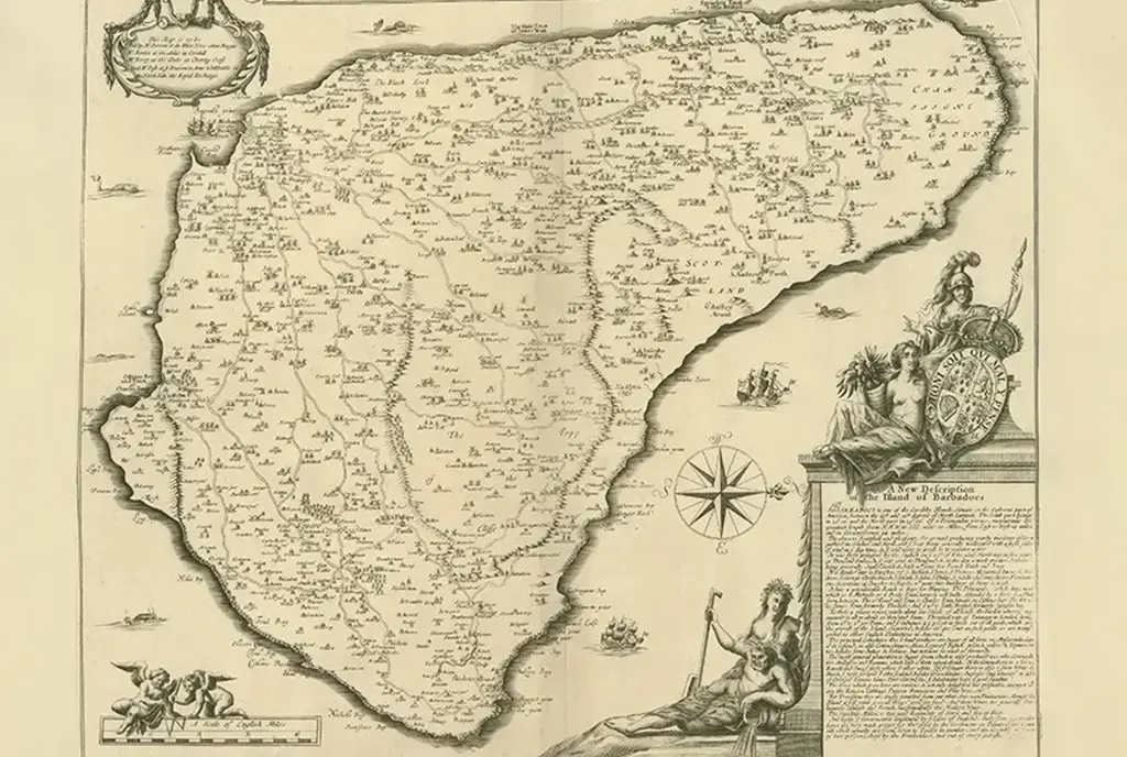
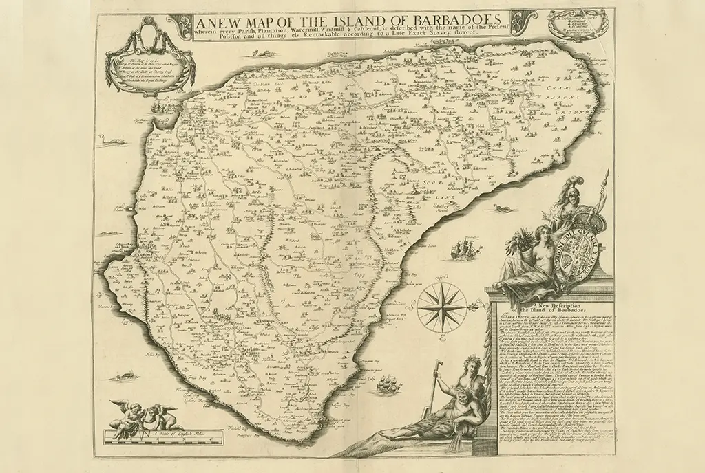
The Printed Maps of Barbados – Part 1: 1500s – 1700
The Printed Maps of Barbados 1500s – 1980s is in 5 sections: 1500s – 1700, 1700 – 1800, 1800 – 1900,1900 – 1980s & Addendums. This is: The Printed Maps of Barbados – Part 1: 1500s – 1700. The follow-on sections are: The Printed Maps of Barbados 1500s – 1980s, brings together the research of…

·
The Printed Maps of Barbados – Part 2: 1700 – 1800
The Printed Maps of Barbados 1500s – 1980s is in 5 sections: 1500s – 1700, 1700 – 1800, 1800 – 1900, 1900 – 1980s & Addendums. This is: The Printed Maps of Barbados – Part 2: 1700 – 1800. The follow-on sections are: The Printed Maps of Barbados 1500s – 1980s, brings together the research…
·
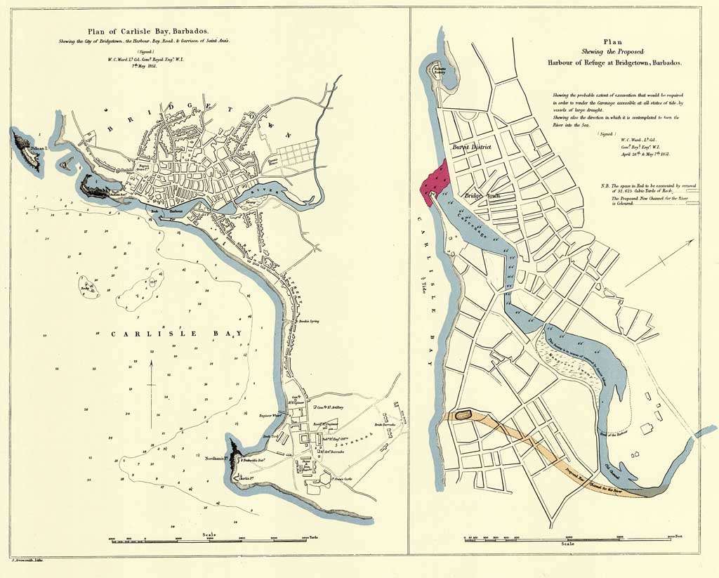
The Printed Maps of Barbados – Part 3: 1800 – 1900
The Printed Maps of Barbados 1500s – 1980s is in 5 sections: 1500 – 1700, 1700 – 1800, 1800 – 1900, 1900 – 1980s & Addendums. This is: The Printed Maps of Barbados – Part 3: 1800 – 1900. The follow-on sections are: The Printed Maps of Barbados 1500s – 1980s, brings together the research…
·
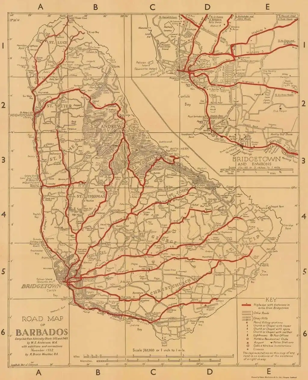
The Printed Maps of Barbados – Part 4: 1900 – 1980s
The Printed Maps of Barbados 1500s – 1980s is in 5 sections: 1500 – 1700, 1700 – 1800, 1800 – 1900, 1900 – 1980s & Addendums. This is: The Printed Maps of Barbados – Part 4: 1900 – 1980s. The follow-on sections are: The Printed Maps of Barbados 1500s – 1980s, brings together the research…

·
The Printed Maps of Barbados – Part 5: Addendums
The Printed Maps of Barbados 1500s – 1980s is in 5 sections: 1500s – 1700, 1700 – 1800, 1800 – 1900, 1900 – 1980s & Addendums. This is: The Printed Maps of Barbados – Part 5: Addendums. The follow-on sections are: The Printed Maps of Barbados 1500s – 1980s, brings together the research of E.…

·
The Quakers in Barbados – The untold story: The will of Samuel Forde
This is the fifth video in a series where John Knox tells the untold story of The Quakers in Barbados focusing in this episode on the will of Samuel Forte and his vault. The above photographs were taken by Professor Hans Machel, Professor emeritus of Geology at the University of Alberta who was staying with…
·
The Quakers in Barbados – The untold story: Drax was a Quaker Family
This is the fourth video in a series where John Knox tells the untold story of The Quakers in Barbados focusing in this episode on the Drax and Codrington families. John has recently setup a YouTube channel: @TheUntoldHistoryOfBarbados. It’s about: The Untold History of Barbados – Amerindians, Quakers and Slavery. As John adds to his…
·
The Quakers in Barbados – The untold story: The wills of Henry Gallop, John Holder, George Foster, his wife Grace and his cousin Thomas
This is the third video in a series where John Knox tells the untold story of The Quakers in Barbados focusing in this episode on the wills of the Gallop, Holder and Foster families. John has recently setup a YouTube channel: @TheUntoldHistoryOfBarbados. It’s about: The Untold History of Barbados – Amerindians, Quakers and Slavery. As…
·
The Quakers in Barbados – The untold story: An Introduction & Addendum
These two videos are the first in a series of videos where John Knox tells the untold story of The Quakers in Barbados. John Knox has documented a number of stories on the History of the Quakers in Barbados for BajanThings: John has recently setup a YouTube channel: @TheUntoldHistoryOfBarbados. It’s about: The Untold History of…
Advertisements

BajanThings
Bajan history. Interesting Bajan people. Hiking in Barbados and Overseas. International Travel…
Category: Barbados Plantations
Barbados Plantations, ownership, acreage, managers, maps…