David Marshall, a great source of information on Barbados, mentioned to me that there were dew ponds in the area of Well House in St. Philip. He said that they collected water to feed animals in the dry times.
I initially thought that these ponds somehow collected dew and stored it. I asked a few people if they ever heard of it but no one knew about them.
I asked Peter if he thought it was a old English word and sure enough he told me to check with Mr. Google.
A dew pond is an artificial pond usually sited on the top of a hill, intended for watering livestock. Dew ponds are used in areas where a natural supply of surface water may not be readily available. The name dew pond (sometimes cloud pond or mist pond) is first found in the Journal of the Royal Agricultural Society in 1865. Despite the name, their primary source of water is believed to be rainfall rather than dew or mist.
Source: Wikipedia – Dew Ponds
These ponds were part of the English farming practice for many hundred years. They are an ingenious solution to a very practical problem of providing water for livestock in areas without natural water sources. Some are still used and others are being restored.
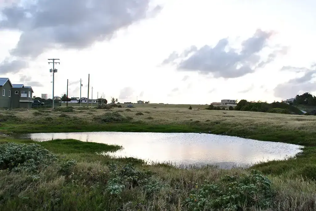
I have found one example of a dew pond in Barbados. It is a few meters from the cliff at Deebles Point, St. Philip. It is man made, circular and not fed by a spring or a stream but by seasonal run off from the surrounding land.
I knew that it was probably used to give the sheep that roamed the area a little water. But I did not know its name or the links to England.
There was a house on the cliff nearby. Daddy said that it was struck by lightning and destroyed. You can still see the remains of a well. I remember my father telling me that it had a windmill that pumped brackish water for the house. But that was a long before I was born.
These ponds are not to be confused with ponds created for migratory birds, which are usually larger and not circular in shape.
They are different from the many other ponds that are the result of sinkholes, or naturally occurring depressions in the land.
A small bit of our history that is interesting and shows our link with England.
Update – 8th January 2025
I walked from Cove Bay along the coast as far as River Bay and returned the same way. Part of reason I choose this route is that this area was very similar to Ragged Point and it was settled very early in the history of Barbados. It may also have Dew Ponds.
I was not disappointing. I met a man on his way for his morning walk and swim at Laycock Bay. We talked for a long time about the area as he grew up there. He confirmed my suspicions that there were man made ponds that were dug years before him, but were still used for the watering cattle and sheep in the area. The description he gave was exactly what a Dew Pond is. However he was not aware of that name but called them according to the area or resident in the surrounding land.
The disused shooting trays, at North Point were originally also used for the watering livestock.
He said there were several between Cove Bay and River Bay. Unfortunately these are no longer visible. There are very few free range livestock to the north of Cove Bay so there is no need for them. Maybe after a few days of heavy rain I may be able to find a few of them. Another reason for a return.
There is a depression at Cove Bay that may be man made and it retains water most months of the year. This is used by the animals that are kept on the field to the south of the old mill-wall.
He also confirmed that there was a graveyard in the area of Chandler Bay. He said it was either a cholera burial ground or a slave burial ground. But the graves had no markers and all are gone with erosion. He called the area “Indian Hill”. As a boy he collected many bits of tools and pottery from the area.
He also told me of a bigger Pond that was much deeper and used for washing clothes. It had a large flat rock called “The Jucking Board”. This pond was called Jenkins Pond.
Barbados needs a to pay more attention to these bits of history that are being lost every day. This area will soon be “developed” for housing with no regard for the history or traditions of the past generations.
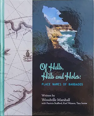
Woodville Marshall has done a fantastic job in his book “Of Halls, Hills and Holes: Place Names of Barbados” of recording many of the place names, their origin and history. But there is nothing on the ground to show their location. So the developer can come with his bulldozer clear the land and put up No Trespass Signs.
It would appear that dew ponds are common in other countries too:
- In Australia, manmade watering holes, similar to dew ponds in the UK, are often referred to as stock dams or farm dams. These are artificial bodies of water created to provide drinking water for livestock and sometimes for irrigation in agricultural areas. They are generally created by digging out a basin or using embankments to capture and store rainwater or runoff.
- In Africa, dew ponds are often referred to as dew catchments or dew wells or dew tanks.
Further Information
A simple search on Google for: Dew Ponds will reveals lots of information. Here are a few interesting one:
- Capturing the Clouds: The History of Britain’s Ancient Dew Ponds
- Creating a Dew Pond
- Restoring and managing dew ponds
- Wolds dew ponds