The Printed Maps of Barbados 1500s – 1980s is in 5 sections: 1500 – 1700, 1700 – 1800, 1800 – 1900, 1900 – 1980s & Addendums. This is: The Printed Maps of Barbados – Part 4: 1900 – 1980s. The follow-on sections are:
- The Printed Maps of Barbados – Part 1: 1500s – 1700
- The Printed Maps of Barbados – Part 2: 1700 – 1800
- The Printed Maps of Barbados – Part 3: 1800 – 1900
- The Printed Maps of Barbados – Part 5: Addendums
The Printed Maps of Barbados 1500s – 1980s, brings together the research of E. M. Shilstone, Tony Campbell, Alan Moss and Jim Webster.

- E. M. Shilstone published “A Descriptive List of Barbados Maps” in 1938 in the fifth issue of the Barbados Museum and Historical Society (BMHS) Journal. Eustace Maxwell Shilstone a Barbadian lawyer co-founded the Barbados Museum & Historical Society (BMHS).
- Tony Campbell authored “The Printed Maps of Barbados” in 1965, (Map Collectors’ Circle, No. 21). This was a key resource and inspiration for this project despite being out of print.
- Alan Moss contributed “Further Notes on The Printed Maps of Barbados” in BMHS Journal volumes XLI (1993) and XLV (1999).
With digital libraries now widely accessible, Jim Webster has expanded on their work, further enriching the collection of printed Barbados maps.
Sourcing Missing Maps, Additional Maps And Map Images
If you can help source images of any of the maps where there is no image or would like to suggest maps of Barbados that should have been included in “The Printed Maps of Barbados 1500s – 1980s” please contact me by either leaving a comment below or clicking on the BajanThings Contact Burts link and choosing from the Subject drop-down: “Barbados Maps – Forward to: Jim Webster”.
Jim Webster – 15th February 2020 (updated February 2025)
Old, historical and antique printed maps of Barbados: 1900 – 1980s
The old, historical and antique printed maps of Barbados are listed chronologically. Maps referenced in Tony Campbell’s book start with a number. Maps referenced by Eustace Shilstone start with a “S”. Other interesting maps added by Jim Webster are denoted with a “W”.
- W [1906] BRITISH WAR DEPT. (BOYCE, ERNEST JG, Col.)
- W [1914] ASPINALL (ALGERNON E. Sir)
- W [1936] ANDERSON (MARGARET SWAINSON), [1952 & 1956] ANDERSON (MARGARET SWAINSON) & MOULDER (RICHARD BRUCE)
- W [1946] MOULDER (RICHARD BRUCE)
- W [1960] DIRECTORATE FOR OVERSEAS SURVEYS
- W [1966] HUDSON (COLIN) SOIL MAP BARBADOS
- W [1986] BARBADOS SOCIETY OF TECHNOLOGIST IN AGRICULTURE
- W [2003] BARBADOS LANDUSE
- W [2024] HOEKVELS (VINCENT) – BARBADOS AT NIGHT FROM 37,000ft
Reference # (Numbers):
Map images from Campbell’s original book have a Plate # and reference No. #. Additional maps, which Campbell described and for which we’ve now added an image have a reference No. # only. The reference # correlates to the map description which are listed chronologically.
Maps referenced by Shilstone, in 1938, but not included in Campbell’s book have been added with a reference # beginning with “S”. eg. S20 would have been the 20th map on Shilstone’s list.
Moss intended that his work: “Further Notes on The Printed Maps of Barbados“, written 30 years after Campbell’s, should be read in conjunction with: “The Printed Maps of Barbados“. Alan Moss’ notes have been included in an indented quote block.
Maps without a plate or reference # have been added and inserted chronologically by Jim Webster in 2020 and denoted with a W.
Coloured Maps:
Prior to the 19th century maps were printed in black and white. In some instances hand colouring was added, after the printing, to enhance readability and appearance. If colouring was done, soon after printing, it was called original or contemporary colour. Colours added later were referred to as modern colour.
Laws of Carto-bibliography:
- Each printed map is an impression made by the transfer of ink from a unique printing platform or group of platforms (usually woodblock, copper plate or lithographic stone).
- The piece of paper we are looking at is no more than a reflection, literally a mirror-image, of a wooden, metal or stone printing platform, which was present in a particular workshop at a particular time.
The carto-bibliographer’s primary task is to recount the life history of a printing platform – the intentional and accidental changes made to it – by attempting to place in order a series of impressions pulled from it.
Tony Campbell “Understanding Engraved Maps“
Our thanks to Tony Campbell for supporting this transcription effort and for giving permission to re-publish “The Printed Maps of Barbados” which forms the basis for this project. You can follow Tony Campbell on Twitter: @portolanchart01.
Tony Campbell is an independent researcher who, for many years has been studying portolan charts. From 1987-2001 he was the Map Librarian at The British Library and is the chair of Imago Mundi Ltd, which has responsibility for Imago Mundi: The International Journal for the History of Cartography and for the coordination of International Conferences on the History of Cartography. We were able to contact Tony in 2018 to learn more about his work and the Barbados map project. He says:
…working up the carto-bibliography of Barbados was my very first foray into map history, done just a few months after I joined the firm of Francis Edwards Ltd, working with R.V. Tooley (author of Maps and Map-makers). The possibilities became immediately apparent when I pulled out the scores of maps of Barbados in the West Indies folder. That enabled me to sort out the different map ‘plates’, and the ‘states’, i.e. altered forms of each, especially of the small Moll maps. If you want to delve into that a bit you might find my article, “Understanding engraved maps“, a useful reference.
Tony Campbell
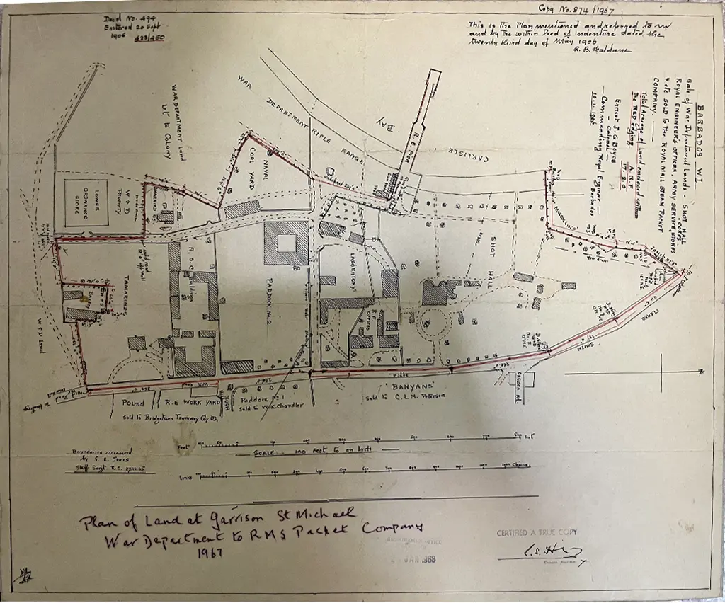
W [1906] BRITISH WAR DEPT. (BOYCE, ERNEST JG, Col.)
In 1906 the British War Department sold off the Barbados Garrison land between the main road and the sea to The Royal Mail Steam Packet Company and others. Today this would be the site of the Barbados Yacht Club, the Island Inn, the Radisson Hotel, a shopping mall, gas station, Christian Science Library and Barbados Light and Power, to name a few.
The map was produced by Col. Ernest J G Boyce Commanding Royal Engineers Barbados dated: 10th January 1906. Included is a note that says boundaries were measured by Staff SGT G E Jones RE dated: 27th December 1905.
W [1914] ASPINALL (ALGERNON E. Sir)
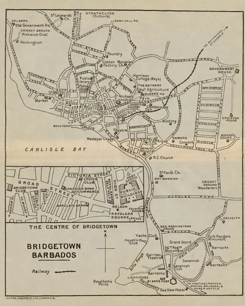
Map of Bridgetown – inserted between pages 98 and 99 of the 1914 edition of: The Pocket Guide to the West Indies, British Guiana, British Honduras, The Bermudas, The Spanish Main and The Panama Canal by Algernon E. Aspinall.
Algernon Edward Aspinall was the Secretary, The West India Committee. In the 1918 New Year Honours, he was made a Companion of the Order of St Michael and St George (CMG), and in the 1939 New Years Honours, he was made a Knights Commander of the Order of St Michael and St George (KCMG).
The Pocket Guide to the West Indies was printed in Great Britain by Ballantyne & Company Ltd, Tavistock Street, Covent Garden, London.
First published in 1907, the guide went through several revisions and reprints over the years. A new and revised edition appeared in 1910, followed by reprints in 1912 and another revised edition in 1914 that included the Bridgetown map. Subsequent editions were issued in 1923, 1931, and 1939. The final edition was published in 1954, two years after the death of its author, Sir Algernon E. Aspinall. This 1954 edition was edited by Professor J. Sydney Dash, who also served as Chief Librarian of the National Library Service of Barbados.
In carrying out the 1954 revision, Professor Sydney Dash largely retained Sir Algernon Aspinall’s narrative, notably in the historical and topographical sections; nearly all the remaining sections were extensively revised, and in some cases were rewritten.
The 1954 edition of The Pocket Guide to the West Indies provides a snapshot of the West Indies during the colonial era, after World War II, and before the impending shift towards islands becoming independent nations. The guide reflects the colonial context of its time, showcasing the region through an “imperial eye”.

University of Florida
Internet Archive – The Library of Congress

Internet Archive – Leiden University Libraries Digital Collections
Internet Archive – Leiden University Libraries Digital Collections

Internet Archive – Leiden University Libraries Digital Collections

Internet Archive – Leiden University Libraries Digital Collections
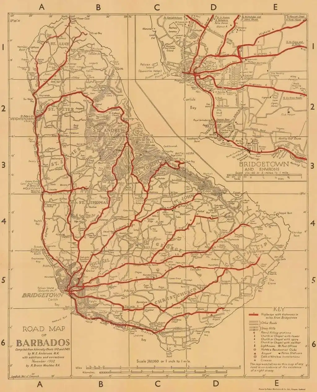
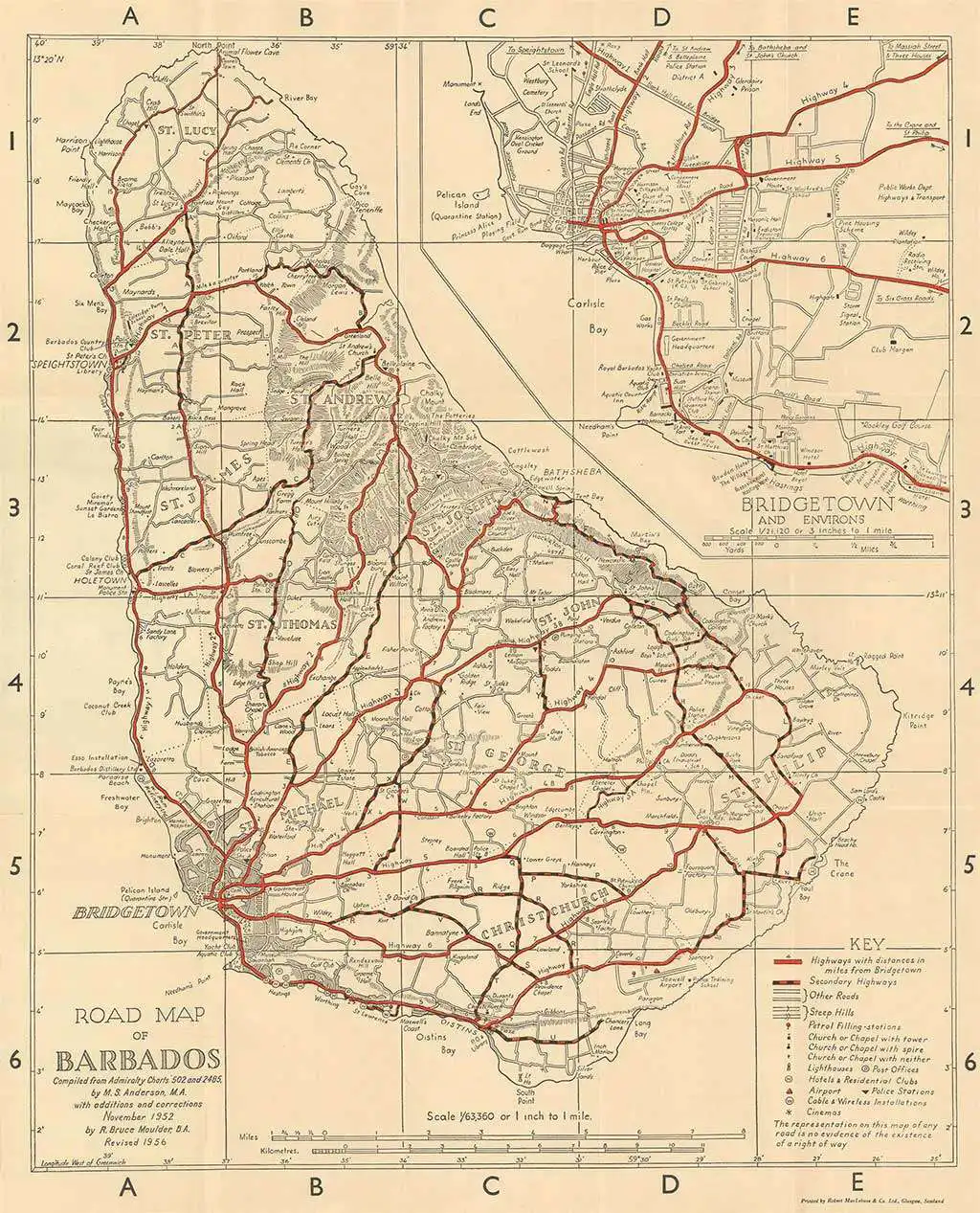
W [1936] ANDERSON (MARGARET SWAINSON), [1952 & 1956] ANDERSON (MARGARET SWAINSON) & MOULDER (RICHARD BRUCE)
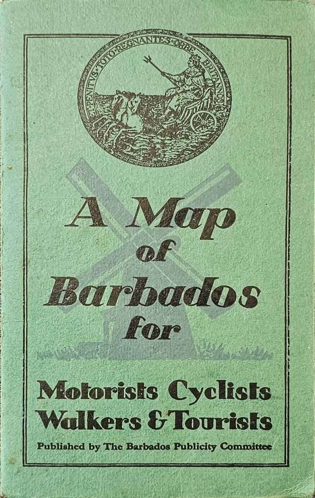
A Map of Barbados for Motorist Cyclist Walkers & Tourist by MS Anderson MA January 1936 with additions and corrections November 1952 by R Bruce Moulder BA, Revised 1956.
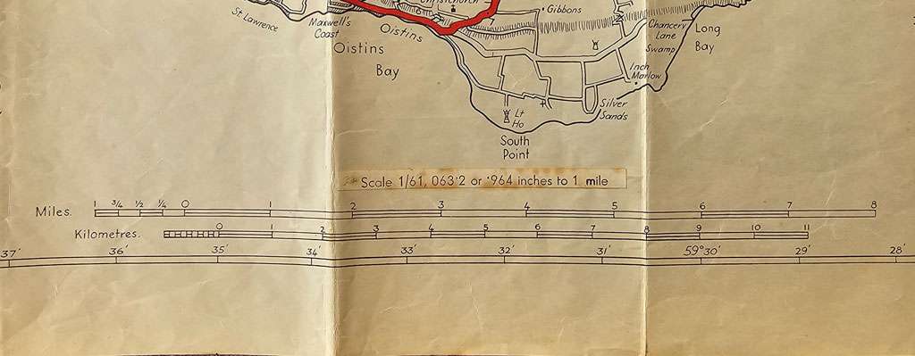
23.25 x 18.75 in (59.055 x 47.625 cm) 1936 edition – 1/61,063’2 or ‘964 inches to 1 mile, 1952 and 1956 editions – 1/63,360 or 1 inch to 1 mile. Printed by Robert MacLehose and Company in Glasgow. Published by the Barbados Publicity Committee.
This was the first “official” road map of Barbados. The map was created by British geographer, cartographer and educator, Margaret Anderson during her time in Barbados 1933 – 36. It was published in 1936 with revisions in 1952 and 1956 with additional contributions from R. Bruce Moulder.
Shown below is a 1936, 1952 and 1956 version of: A Map of Barbados for Motorist Cyclist Walkers & Tourist Published by The Barbados Publicity Committee.
Margaret Anderson created the first road map of Barbados while resident in Barbados from 1933 – 1936. The 1936 map was published at a time when the land was largely agricultural when most residents lived and worked on sugar plantations or in the four main urban centres. The road network had remained virtually unchanged for over 250 years and is still the core of the present day road system. A few, new residential areas were just beginning to appear. A few hotels can be found on the south coast and the famous Sandy Lane Hotel, of today, was the site of a sugar factory. There was no Seawell Airport which is not surprising as Seawell did not come into being until September 1938 and then consisted of a grass airstrip. Prior to that Rockley Golf Club which is marked was used as a makeshift airstrip. The scale of the 1936 edition is slightly different to the 1952 and 1956 edition. The 1936 edition has stuck over the scale an erratum label that says “1/61,063’2 or ‘964 inches to 1 mile”. Holding the map up to the light the original printed scale says “1/63,360 or 1 inch to 1 mile” which is the scale used for the 1952 and 1956 editions.

R. Bruce Moulder a long-time resident of the island contributed to the compilation of the 1952 update. The roads are marked in a bold red and there is a large inset of Bridgetown on the upper right. More features useful to the visitor or traveller, such as Petrol Filling-stations, Hotels and Residential clubs, Airport, Police Stations, Cable & Wireless Installations and Cinemas are included in the key in the lower right. The scale of the 1952 and 1956 editions changed to 1/63,360. Also the horizontal grid lines are given by bold numbers 1 to 6 down the right and left hand side of the map and the vertical grid lines are given by bold letters A to E along the top and bottom of the map.
Geographicus Rare Antique Maps
For the 1956 update red lines highlight major highways, while red and black dashed lines follow secondary highways. Distances along the major highways are marked by small numbers near the route. Roads marked by two thin black parallel lines are ‘other roads’ per the key situated in the lower right corner. As per the 1952 edition symbols mark Petrol Filling-stations, Hotels and Residential clubs, Airport, Police Stations, Cable & Wireless Installations and Cinemas and an inset of Bridgetown and its environs is situated in the upper right.
Geographicus Rare Antique Maps
W [1946] MOULDER (RICHARD BRUCE)
The Pleasant Isle of Barbados by R Bruce Moulder in 1946.
21.25 x 17.25 in (53.975 x 43.815 cm) 1:63,360.
Printed by Robert MacLehose and Company in Glasgow.
Published by the Barbados Publicity Committee.
Pictorial icons illustrate the island’s sugar factories, windmills, and lighthouses. Short descriptions provide historical information. Beaches where swimming is possible are noted with the word ‘seabathing’. Red dotted and dashed lines separate the island’s parishes, each of which is labelled. The Caribbean’s diverse sea life encircles the map, with illustrated images of a hawksbill turtle, a flying fish, and a red snapper.
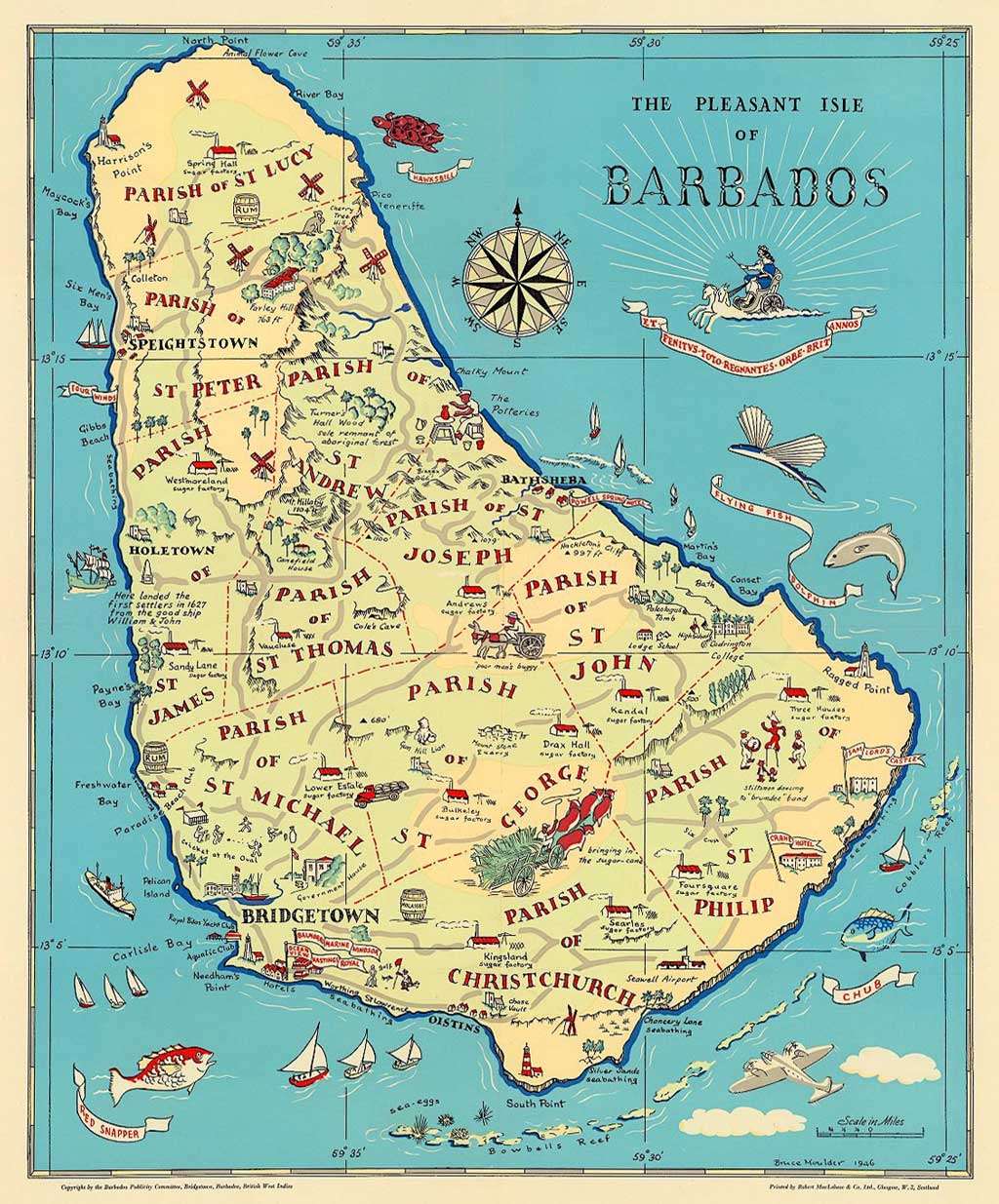
David Rumsey Map Collection
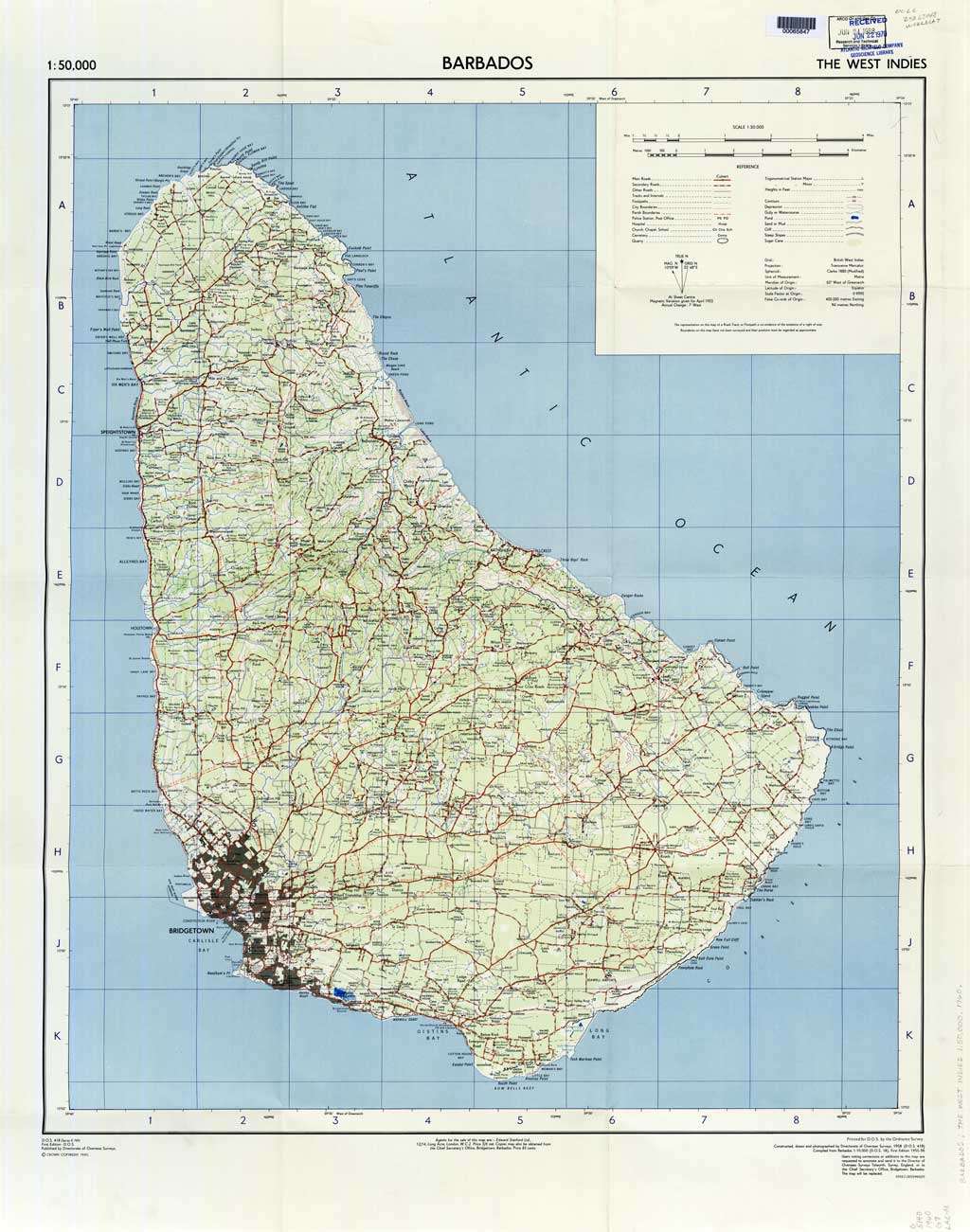
W [1960] DIRECTORATE FOR OVERSEAS SURVEYS
Directorate of Overseas Surveys (D.O.S.), 1958. Barbados.
D.O.S. 418 (Series E. 749) 1:50,000 Crown Copyright 1960
Complied from Barbados 1:10,000 (D.O.S. 18), First Edition 1955 – 56.
Agents for this map are: Edward Stanford Ltd., 12/14, Long Acre, London, W.C.2. Price 3/6 net. Copies may also be obtained from the Chief Secretary’s Office, Bridgetown, Barbados. Price 85 cents.
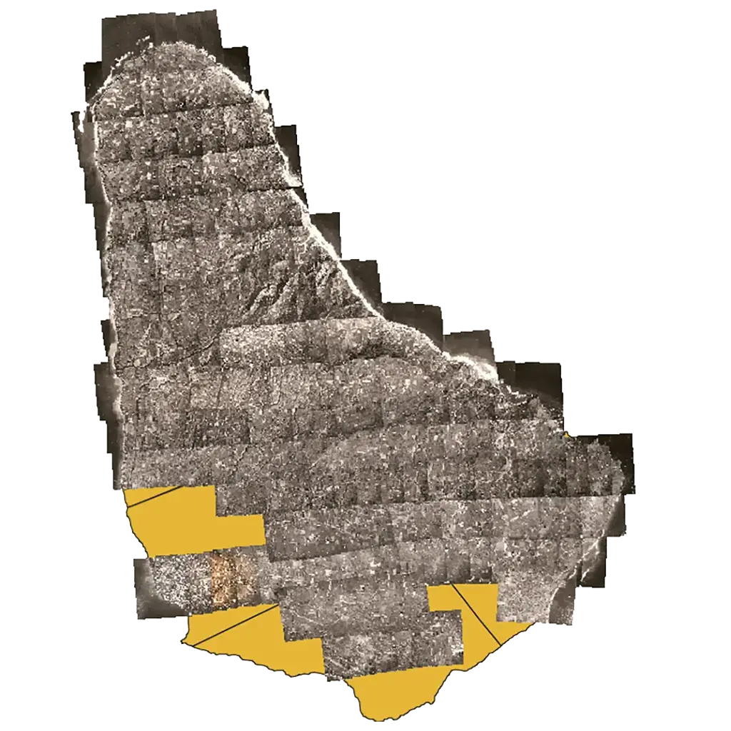
At the end of 1950 and in early 1951, the first Aerial photography of Barbados was done, a 1:10,000 paper map was produced in 18 sections and a coordinate system assigned.

Flight paths from east west and vice versa with a slight northward tilt on the east coast were made. Photographs were taken at intervals to allow for overlap of the images and the extraction of elevation detail using stereoscopic viewing. That technology had been “perfected” in WWII as each side used aerial photo reconnaissance to spy on the other. Today, satellites do the job, photographs are in digital form, and computer software crunches the numbers. An example of the flight path over St. Thomas with its individual photos and overlap is shown below.

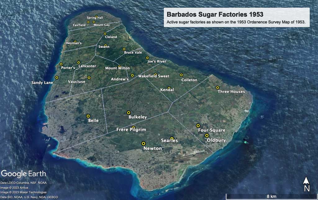
This map is possibly one of the last maps to show the sugar plantations and factories prior to many being sold for residential and industrial development which began to become prevalent in the late 1960’s and the 1970’s. As sugar production dropped factories consolidated and many were closed in subsequent years.
The University of Texas at Austin
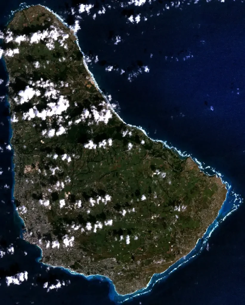
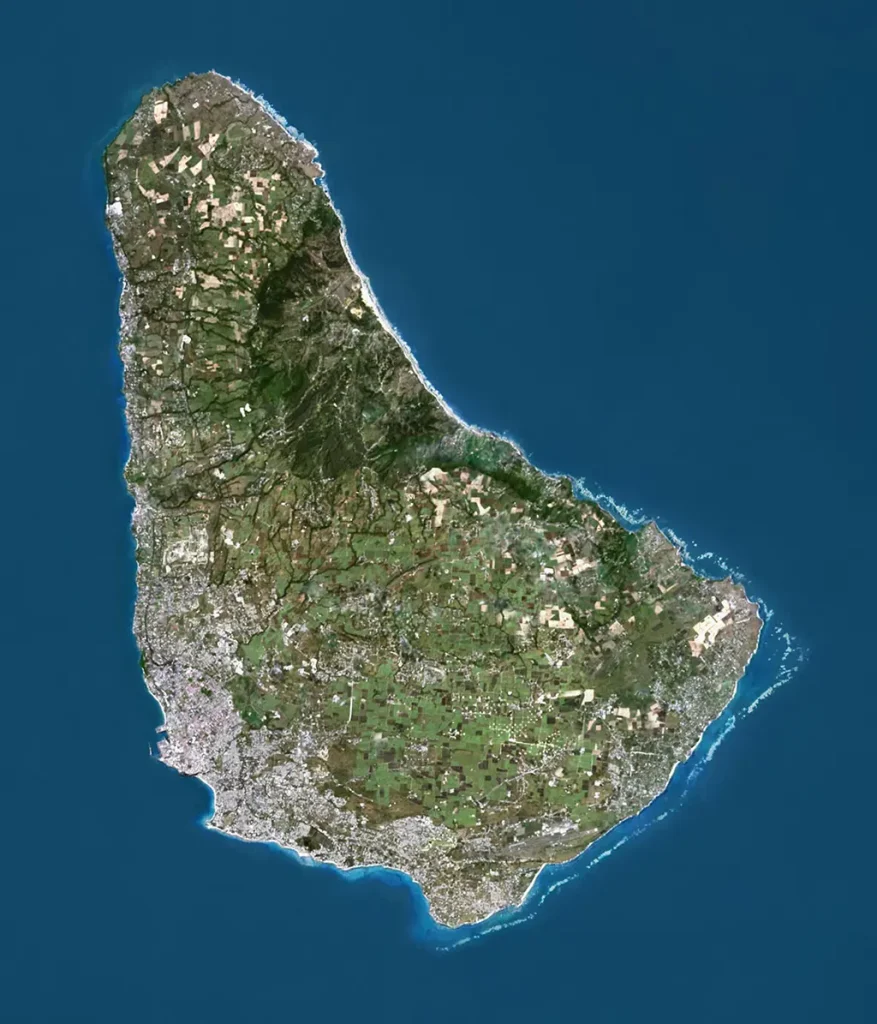
The aerial photography technology used by the Directorate of Overseas Surveys (D.O.S.) in 1958 to map Barbados has now moved on with the use of widely available commercial satellite imagery.
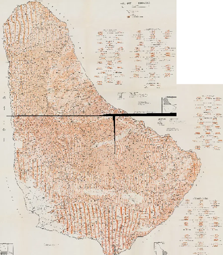
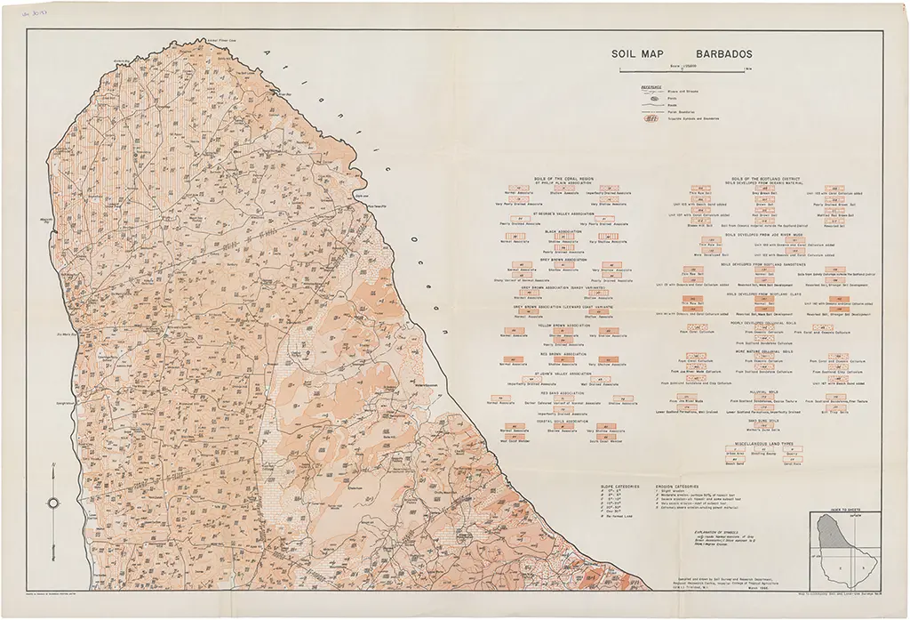
W [1966] HUDSON (COLIN) SOIL MAP BARBADOS
The 1966 Soil Map Barbados – on 3 sheets at a scale of 1/25,000 was inspired by Dr. Colin Hudson.
The Soil Map Barbados was compiled and drawn by Soil Survey and Research Department, Regional Research Centre, Imperial College of Tropical Agriculture (UWI) Trinidad WI. It was published by: Imperial College of Tropical Agriculture, University of the West Indies, Soil and Land-Use Section of The Regional Research Centre. It was printed in Trinidad by Caribbean Printers Limited in March 1966. A footnote states: Map to accompany Soil and Land – Use Survey No. 18.
This 3 sheets shown below were stitched together and geofenced by John Knox.
Wageningen University and Research eDepot

Wageningen University and Research eDepot

Wageningen University and Research eDepot
W [1986] BARBADOS SOCIETY OF TECHNOLOGIST IN AGRICULTURE
Barbados Weather Map from 1986 compiled by Barbados Society of Technologist in Agriculture. Distributed by the Agriculture Department of Plantations Trading Company. Rainfall data by Transenergy Consultants Ltd. Graphics by Professional Computing Services.
This map from 1986 shows why Barbados is a water scarce country. Evapotranspiration rate exceeds the precipitation rate for 5-6 months of the year on average. It also shows the importance of the higher elevations to rainfall. In January, for instance a tiny area in the Farmer’s area is the only area which contributes to the recharge of our underground aquifers.
John Knox
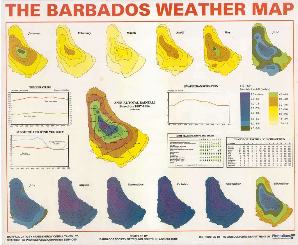
sent to BajanThings by John Knox
W [2003] BARBADOS LANDUSE
Land use map 2003 taken from: Barbados Planning & Development Department: Public Consultation on Draft Physical Development Plan Amended 2023.

Barbados Planning & Development Department
W [2024] HOEKVELS (VINCENT) – BARBADOS AT NIGHT FROM 37,000ft
Not technically a map. This photograph was taken by KLM Airlines pilot Vincent Hoekveld at night from high altitude while overflying Barbados on 1st January 2024 on a flight from Port-of-Spain, Trinidad to Amsterdam, Netherlands (KLM781).

This is: The Printed Maps of Barbados – Part 4: 1900 – 1980s. Click here to go to the previous or next section of The Printed Maps of Barbados 1500s – 1980s: